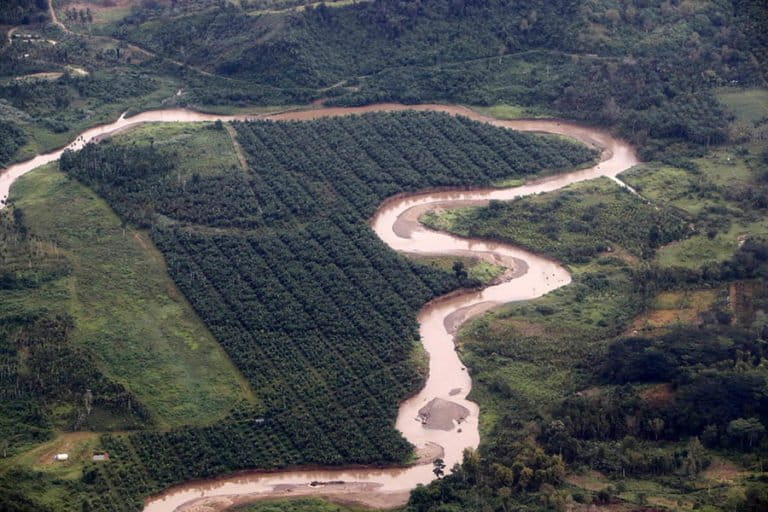
Rivers Disappearing Within Palm Oil Concessions Raise Ecological Concerns in Indonesia
In Indonesia's Riau province, palm oil plantations are encroaching on riverbanks, raising concerns about ecological destruction. The phenomenon of 'disappearing' rivers signifies a loss of recognition, protection, and management, not just water volume, signaling a widespread environmental issue.
This article requires PRO
This article is outside the free access window or is a special report. PRO unlocks it and the full archive.
Related articles
- Indonesian Parliament Highlights Plight of Indian Muslim Minority at International Forum
Indonesia's parliamentary committee for international cooperation (BKSAP) has highlighted the suffering of Muslim minorities in India, alongside issues in Palestine and Sudan, at an international forum. This move underscores Indonesia's commitment to human rights advocacy on the global stage.
- Scam Information Spreading Under Bali Governor's Name, Suspected AI Misuse
A scam video claiming to distribute IDR 100 million in cash through a quiz, using the name of Bali Governor Wayan Koster, is circulating on social media. The misinformation is suspected to be edited using AI from past footage, and the governor's office is urging caution.
- Gibran's Diploma Lawsuit: Judge Saldi Isra Begins Reading Verdict
In an Indonesian court, Judge Saldi Isra has begun reading the verdict in a lawsuit challenging the academic credentials of Vice Presidential candidate Gibran Rakabuming. The lawsuit contested the validity of Gibran's degree.
- Taiwan Coast Guard Operation Fuels Hardline Sentiment in China
A maritime law enforcement operation by Taiwan's Coast Guard has exposed a particularly hardline strand of opinion towards Taiwan among some in mainland China, reflecting complex emotions and political calculations in cross-strait relations.