General articles are free for 24 hours after publish.
Ho Chi Minh City Faces 2cm Annual Land Subsidence: Experts Urge 100-Year Planning
Ho Chi Minh City is experiencing an average annual land subsidence of 2cm, prompting experts to call for long-term urban planning and flood mitigation strategies with a 100-year outlook. Factors like groundwater extraction and rapid urbanization are contributing to increased flooding. The city plans significant infrastructure investments.
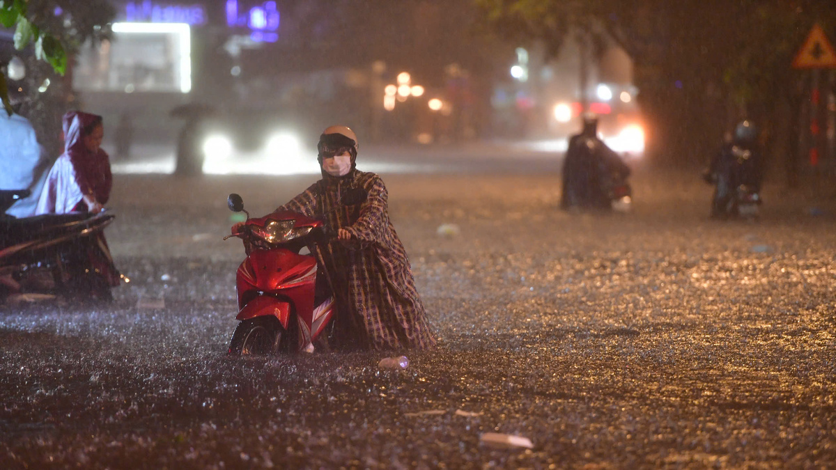
Experts are sounding the alarm over land subsidence in Ho Chi Minh City, with some areas sinking at an average rate of 2cm per year. They emphasize the urgent need for long-term urban planning and flood mitigation strategies that look 100 years ahead. This phenomenon, exacerbated by factors such as excessive groundwater extraction and rapid urbanization, is significantly contributing to the increasing frequency and severity of flooding. Associate Professor Dr. Nguyen Phu Quynh, Deputy Director of the Southern Institute of Water Resources Science, stated at a workshop on flood control, drainage, and urban wastewater treatment in Ho Chi Minh City on September 15 that if the subsidence rate averages 2cm annually, the ground level could be about one meter lower in 50 years, potentially necessitating the construction of extensive dikes along the Saigon River. He noted that various studies indicate the complex nature of land subsidence in certain parts of the city, with rates not necessarily constant year-on-year as the soil compacts. However, the city must conduct specific research and forecast risks to proactively develop response scenarios. Hoang Quang Huy, a flood risk management expert from Haskoning Netherlands, corroborated the severity, citing Thao Dien area, which rarely flooded 20 years ago but now experiences frequent inundation during heavy rains or high tides due to changes in ground elevation from subsidence. Previous research from 2006-2020 recorded subsidence rates of 2-5cm per year in the city, with some areas experiencing 7-8cm annually due to weak geological foundations or concentrated commercial development. Key drivers include the city's location on soft, compressible Holocene sediments, extensive groundwater pumping, rapid urbanization, and the load from construction projects. Dr. Quynh further advised that Ho Chi Minh City must also forecast sea-level rise for different periods. This data is crucial for integrated urban planning with a 100-year vision and for selecting appropriate flood mitigation solutions. He stressed that a fundamental solution requires a simultaneous combination of slowing water flow, water storage, and enhancing drainage capacity during heavy rains and high tides. Following the administrative expansion, Ho Chi Minh City now has approximately 159 flood-prone points, with many in the old city center and surrounding former provinces experiencing prolonged inundation during rains or high tides. Dutch Consul General Raissa Marteaux highlighted the need for a comprehensive strategy for flood control and wastewater treatment, emphasizing efficient water resource management beyond just infrastructure. She called for greater participation from urban planners and businesses. Le Ngoc Linh, Deputy Director of the Ho Chi Minh City Department of Construction, acknowledged the significant differences in topography and hydrology across the expanded city area. The city is increasingly impacted by extreme weather, high tides, sea-level rise, and subsidence. Outdated urban plans and uncoordinated drainage systems contribute to control limitations. To address these issues, the city plans to complete 87 projects totaling approximately 140 trillion VND (around $6 billion USD) between 2026-2030, aiming to resolve about 50 major flooding hotspots. Flood control management will shift from point-based solutions to comprehensive basin-wide approaches, considering extreme weather, tides, sea-level rise, subsidence, urban planning, and water storage spaces. The department intends to integrate traditional drainage systems with green infrastructure, retention ponds, water storage areas, and nature-based solutions. Feedback from the workshop will be incorporated into refining the city's flood mitigation strategies.
Original source
VnExpress