Tropical Depression Forms in South China Sea, No Impact on Vietnam Mainland
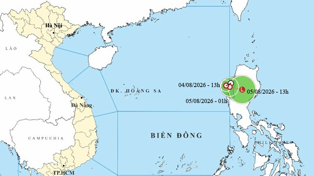
A tropical depression formed in the northern South China Sea on the afternoon of August 4, intensifying into a tropical storm. Meteorological authorities predict it will weaken within about a day and have no impact on mainland Vietnam, though strong winds and high waves are expected in specific maritime areas.
This article requires PRO
This article is outside the free access window or is a special report. PRO unlocks it and the full archive.
Related articles
- Tropical Depression Forms in South China Sea, Direct Impact on Vietnam Mainland Limited
A tropical depression has formed and intensified in the South China Sea. The National Center for Hydro-Meteorological Forecasting has issued warnings for rain and strong winds along coastal areas and rough seas. Currently, direct impact on the Vietnamese mainland is deemed limited.
- Tropical Depression Forms in South China Sea, No Direct Impact on Vietnam Mainland
A tropical depression has formed in the South China Sea, northeast of Vietnam's coast. It intensified into a tropical storm on August 4th but is not expected to directly impact Vietnam's mainland or coastal areas. Mariners are advised to exercise caution.