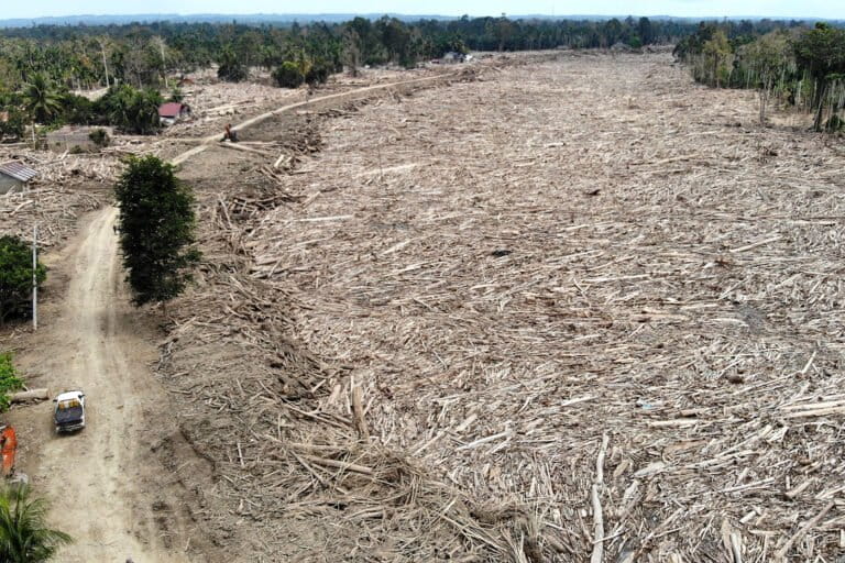
Sumatra-Aceh Disasters Worsened by Protected Zone Pressure, Ministry Investigates
Indonesia's Ministry of Environment is investigating the devastating disasters in Sumatra and Aceh. While tropical cyclones are a potential trigger, human activities, particularly pressure on protected zones and mangrove forests, are being examined as factors that may have exacerbated the disaster's impact.
This article requires PRO
This article is outside the free access window or is a special report. PRO unlocks it and the full archive.
Related articles
- Indonesia Strengthens Forest Fire Control Amid Rising Hotspots
Indonesia is strengthening its forest fire suppression operations as 'hotspots' show an increasing trend. The Ministry of Environment and Forestry is bolstering efforts, especially in regions experiencing the dry season.
- Indonesia and Norway Launch Joint Funding Service for FOLU Net Sink 2030
Indonesia and Norway have launched the fifth phase of their joint funding service, "Dana Masyarakat FOLU Net Sink 2030," aimed at achieving Net Sink for Forest and Other Land Use (FOLU) emissions by 2030. This initiative strengthens the climate action cooperation between the two nations.
- Why the Amazon's Main Trunk Lacks Bridges, and the Deforestation Risk Posed by the Sole Crossing
The Amazon River's main trunk, stretching over 6,000 km, lacks any bridges due to a lack of pressing economic necessity and low population density. The sole existing bridge crosses a tributary, but its construction is linked to increased deforestation in surrounding areas.
- Pacific Islands Urge World Leaders to Take Action on Climate
Pacific island nations are strongly urging the international community to take more robust action against climate change, facing severe impacts that threaten their very existence. This plea highlights the urgency of the climate crisis for these vulnerable countries.