General articles are free for 24 hours after publish.
Ngaungdon Island Embankment Collapses Further by About 300 Feet, Approximately One Furlong of Embankment Soil Was Washed Away
AYEYARWADDY TIMES September 5 It has been reported that approximately 300 feet of soil has newly collapsed on the Ngaungdon Island Embankment (Toe River, a distributary of the Ayeyarwaddy River) between mileposts 11/6 an
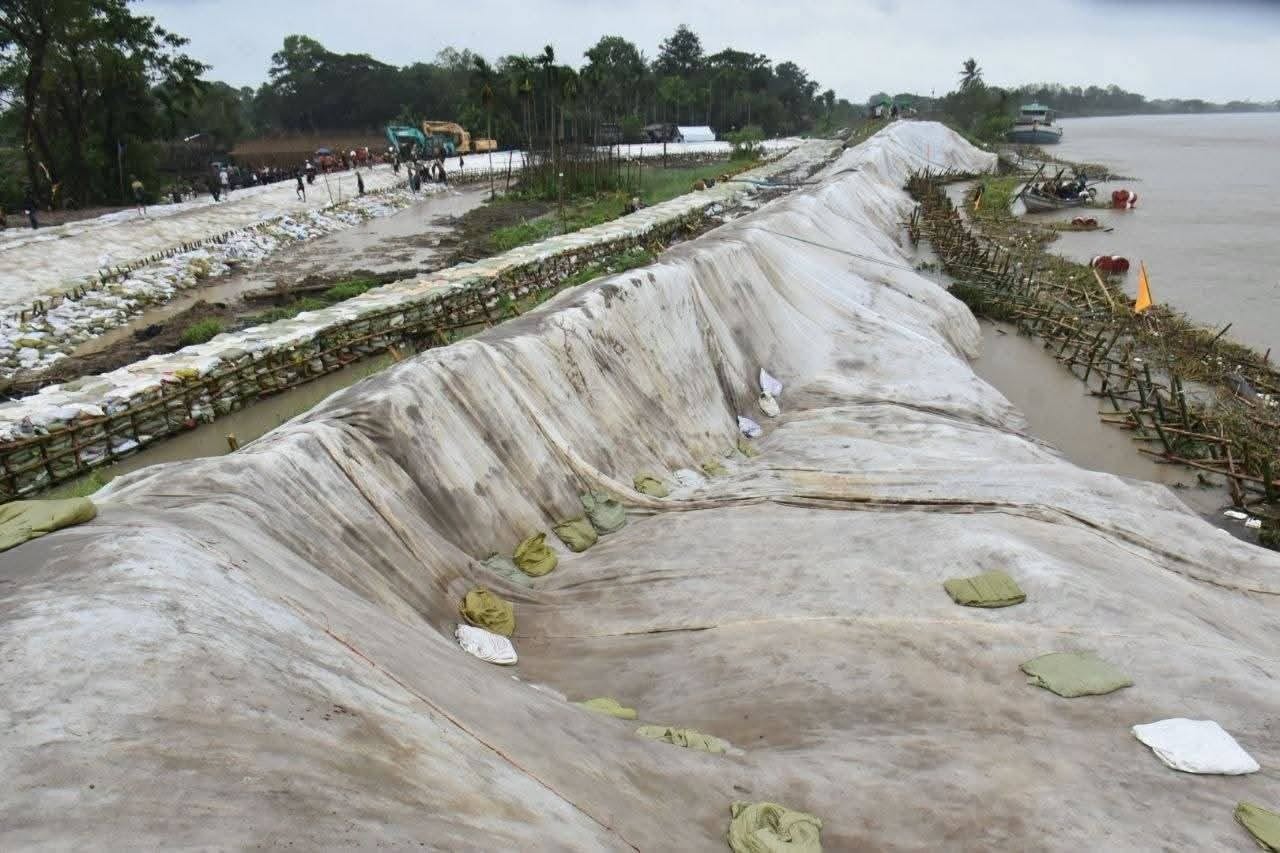
AYEYARWADDY TIMES September 5 It has been reported that approximately 300 feet of soil has newly collapsed on the Ngaungdon Island Embankment (Toe River, a distributary of the Ayeyarwaddy River) between mileposts 11/6 and 11/7, bringing the total amount of soil collapsed in the past ten days to approximately one furlong (600 feet). The Ngaungdon Island Embankment near Kan Chaung Village in Nga Thorne Township, Ayeyarwaddy Region, saw an additional collapse of about 300 feet on September 5. This is in addition to the collapse of the embankment body, approximately 300 feet in length and 45 feet in width, on August 25, bringing the total collapse to about 600 feet (one furlong). Furthermore, a collapse of the embankment body, approximately 350 feet in length, is occurring between mileposts 11/5 and 11/6 of the said Ngaungdon Island Embankment. If the embankment soil between mileposts 11/5 furlong and 11/7 furlong collapses continuously, the embankment could break, leading to potential flooding. Although the embankment has collapsed, there has not yet been any water ingress to the extent of severe flooding. However, water is seeping from the soil to the other side, according to a local resident of Ngaungdon. "It collapsed at 6 AM this morning. The remaining part between mileposts 11/6 and 11/7, which had already been collapsing, gave way. It became a continuous collapse with the previous one. The water vortex control structures in front of the embankment were also washed away. The water hit the embankment and it couldn't withstand it," a Ngaungdon local told the Ayeyarwaddy Times. Although sandbags are being used to reinforce the base of the Ngaungdon Island Embankment, which has collapsed due to erosion by the Toe River, the situation is not good in its current state, and reinforcement with human and mechanical power is deemed necessary, according to a local resident. Acting President Min Aung Hlaing visited the Ngaungdon Embankment repair site on August 29 and instructed that measures be taken to control water ingress, ensure the long-term strength of the embankment, and prepare necessary materials and machinery for emergencies. However, it has been learned that the actual situation has not allowed for the containment of the Ngaungdon Embankment collapse. The Kan Chaung village, where the Ngaungdon Island Embankment is located, lies beside the Yangon-Mawbin highway. Nga Thorne Township is situated at an elevation of 20 feet above sea level, in a delta region with numerous streams, canals, and lakes, and is traversed by the Ayeyarwaddy River, the Pan Hlaing River, and the Boloel River. Photo – Social Media
Original source
Ayeyarwaddy Times