General articles are free for 24 hours after publish.
Heavy Rains Cause Widespread Flooding and Disrupt Transport in Central Vietnam
Record heavy rainfall in western Nghe An province, central Vietnam, has led to widespread flooding of roads and homes, disrupting transportation and significantly impacting residents' lives. Authorities are engaged in rescue and recovery efforts.
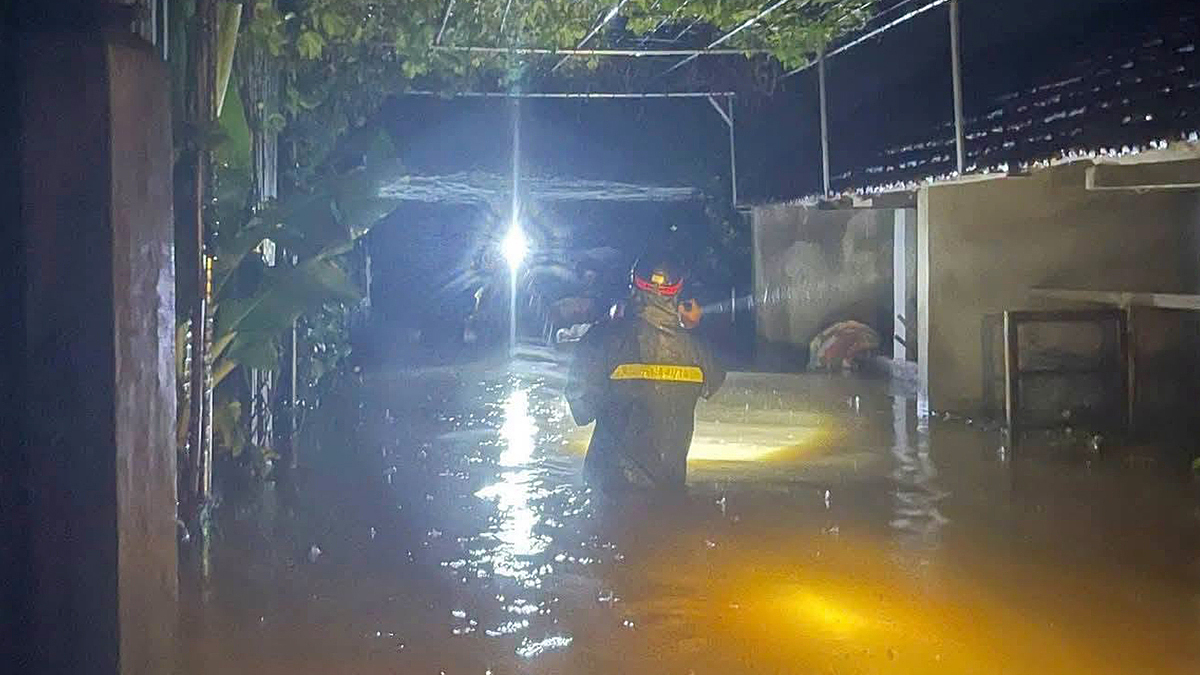
Widespread flooding and significant disruptions to daily life and transportation have occurred in central Vietnam, particularly in western Nghe An province, following several days of heavy rainfall. Many roads and residential areas have been inundated, with some communities becoming isolated. Low-lying homes have also been affected, causing distress among residents. Authorities are actively engaged in rescue and recovery operations. In Tam Thai commune, formerly part of Tuong Duong district, two days of intense rain caused rivers and streams to swell, flooding numerous roads by 30-40 cm. This has led to the isolation of seven hamlets, home to 631 households and over 3,000 residents, as well as two schools. Around 7 PM on September 15, authorities received a report from a family requesting assistance to transport a 38-year-old woman experiencing severe abdominal pain, suspected to be acute appendicitis, for emergency medical care. Police and military personnel deployed ropes to help the woman cross three fast-flowing, submerged culverts, nearly half a meter deep, on provincial road 541B to reach the Tuong Duong Medical Center. Her condition is currently stable. At 7 AM on September 16, National Highway 48 near the former Nghia Thuan commune, now Thai Hoa city, was submerged by 30 cm of water. Vehicles traveling from Vinh, Dien Chau, and Quynh Luu to the western mountainous areas experienced prolonged traffic jams stretching hundreds of meters, forcing many to turn back. National Highway 48, approximately 20 km long, is a vital transport artery connecting the lowlands with the western mountainous regions of Nghe An, passing through Nghia Dan, Quỳ Hop, Quỳ Chau, and Que Phong. The road typically sees heavy traffic from trucks transporting goods and materials. Meanwhile, in Quynh Van commune (formerly part of Quynh Luu district), floodwaters entered some low-lying residential areas on the night of September 15, submerging 12 homes by 30-40 cm. Tens of hectares of crops in the former Quynh Van area were also submerged and damaged. By the morning of September 16, the water had receded, and residents were busy cleaning their belongings and homes. The National Center for Hydro-Meteorological Forecasting stated that the heavy rainfall is due to a combination of easterly and southeasterly winds and a cold air mass. For September 16-17, Hanoi, Hung Yen, Ninh Binh, Thanh Hoa, Phu Tho, northern Nghe An, and southern Lao Cai are forecast to receive 70-170 mm of rain, with localized areas exceeding 250 mm. The meteorological agency predicts a flood peak in rivers in the northern region and Thanh Hoa province on September 16. Within the next six hours, Son La, Phu Tho, Lao Cai, Quang Ninh, Thanh Hoa, and Nghe An provinces face a high risk of flash floods in small rivers and streams, as well as landslides on steep slopes. The disaster risk level is warned as Level 1, with Phu Tho province at Level 2.
Original source
VnExpress