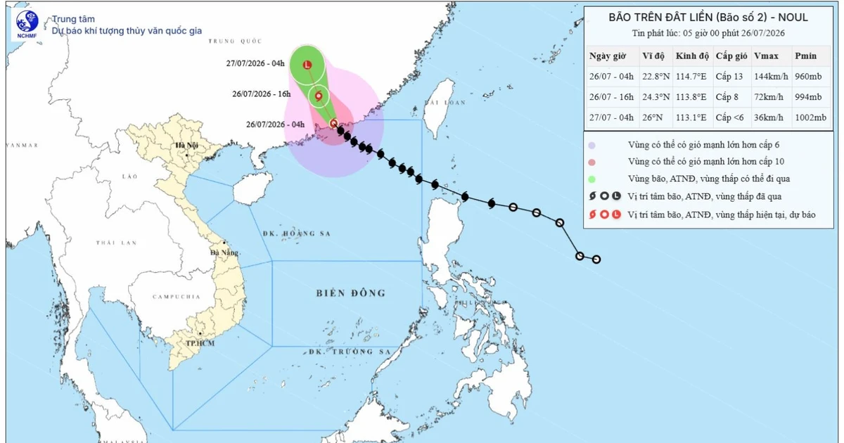
Typhoon No. 2 Makes Landfall in China's Guangdong Province, No Direct Impact on Vietnamese Mainland
According to Vietnam's National Center for Hydro-Meteorological Forecasting, Typhoon No. 2 has made landfall in southern Guangdong Province, China, and is weakening as it moves inland. No direct impact on the Vietnamese mainland is expected, though high waves and strong winds may affect the northern Tonkin Gulf.
This article requires PRO
This article is outside the free access window or is a special report. PRO unlocks it and the full archive.
Related articles
- China Military Aircraft at Laos Facility Raise Regional Concerns
Satellite imagery shows Chinese military training aircraft and support vehicles at a newly operational China-Laos joint training facility in Laos. Security experts view this as a sign of China's expanding military presence beyond its borders, raising concerns among neighboring countries like Vietnam.
- Vietnam, Panama Ink Cooperation Pacts in Maritime Transport, Crime Fighting, Agriculture, Tourism
Vietnam and Panama signed cooperation documents in maritime transport, transnational crime fighting, agriculture, and tourism, witnessed by their top leaders. These agreements aim to strengthen substantive ties between the two nations.
- Vietnam-Laos Summit to Usher in New Era of Economic Cooperation
Vietnamese Prime Minister Le Minh Hung's upcoming visit to Laos is set to focus on strengthening bilateral economic cooperation, with discussions expected to center on achieving trade and investment targets and deepening economic linkages.
- Vietnam's Communist Party Emphasizes Cadre Qualities in Tackling Complex Challenges
Vietnam's Communist Party is highlighting the importance of cadres' decisiveness, responsibility, and capabilities when facing complex and unprecedented challenges. At a Central Committee plenum, party leadership indicated that the ability to respond in such critical situations will be a key evaluation criterion for officials.