General articles are free for 24 hours after publish.
Cambodia Strengthens Local Governance and Development Foundation by Finalizing Administrative Boundary Maps
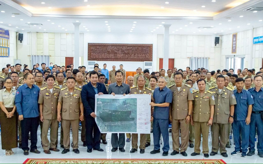
Cambodia signed administrative boundary maps for communes and sub-districts on September 17th. This initiative is crucial for efficient local administration, public service delivery, and land management, expected to bolster development planning, particularly in economically active areas like Banteay Meanchey province.
The signing of administrative boundary maps for communes and sub-districts is being positioned as a crucial step towards strengthening the foundation for local governance and development in Cambodia. On September 17th, in Banteay Meanchey province, a signing ceremony for the finalized administrative boundary maps of communes and sub-districts was held. The event was attended by His Excellency Lao Davouth, Secretary of State of the Ministry of Land Management, Urban Planning and Construction, representing His Excellency Say Sam Al, Deputy Prime Minister and Minister of the Ministry of Land Management, Urban Planning and Construction. Also present were His Excellency Ouk Ratree, Governor of Banteay Meanchey Province, His Excellency Plack Varry, Chairman of the Provincial Council, His Excellency Vuthy Runnara, Director General of the General Department of Cadastral and Survey of the Ministry of Land Management, Urban Planning and Construction, Mr. San Chamroeun, Deputy Director General of the General Department of Administration of the Ministry of Interior, along with deputy governors from Battambang and Oddar Meanchey provinces, mayors of all nine districts, heads of provincial departments and units, commune/sub-district chiefs, and commune/sub-district scribes. His Excellency Lao Davouth emphasized that the clear definition of administrative boundaries for communes and sub-districts is not merely a technical exercise involving maps but serves as a vital foundation for organizing administration, providing public services, local development, and efficient and precise land management. He highlighted that clear administrative boundary maps are essential for relevant institutions and sub-national administrations in planning development, managing resources, delivering public services, and implementing administrative functions within their respective jurisdictions. Furthermore, clearly defining boundaries helps reduce ambiguity in local land management, especially in areas where boundaries connect between communes/sub-districts or between adjacent districts/cities and provinces. The availability of clear documents and maps enables authorities at all levels to work in coordination and have specific reference points. His Excellency Lao Davouth urged local authorities and relevant officials to continue paying close attention to the accurate implementation of work related to administrative boundaries, in accordance with the agreed and signed maps and documents. He also called for close cooperation to ensure that land management at the local level proceeds in an orderly and effective manner. His Excellency Ouk Ratree expressed his support for the work of defining and confirming administrative boundaries within Banteay Meanchey province, considering it important for strengthening administrative management at the local level and for establishing clarity in the work execution of communes/sub-districts, districts/cities, and provincial administration. This signing ceremony also demonstrates cooperation between relevant ministries, institutions, and sub-national administrations in systematizing land management and establishing a clear database. Notably, the participation of commune/sub-district chiefs and scribes, who are the direct implementers at the grassroots level, is a crucial part of ensuring that information related to administrative boundaries is understood and applied correctly. For Banteay Meanchey province, which is experiencing continuous growth in economic, social, and development activities, having clear administrative boundary maps will serve as a basis for planning development and managing the locality more effectively, in line with the roles and responsibilities of each administration. Therefore, this signing ceremony for commune/sub-district administrative boundary maps is not just a formal event but a continuation of strengthening the foundation for clear, orderly, and responsible land management, which will contribute to better public service delivery and local development that responds to the needs of the people. Source: AKP Khmer
Original source
AKP Khmer