General articles are free for 24 hours after publish.
LPA Approaches Philippines, May Intensify into Tropical Depression
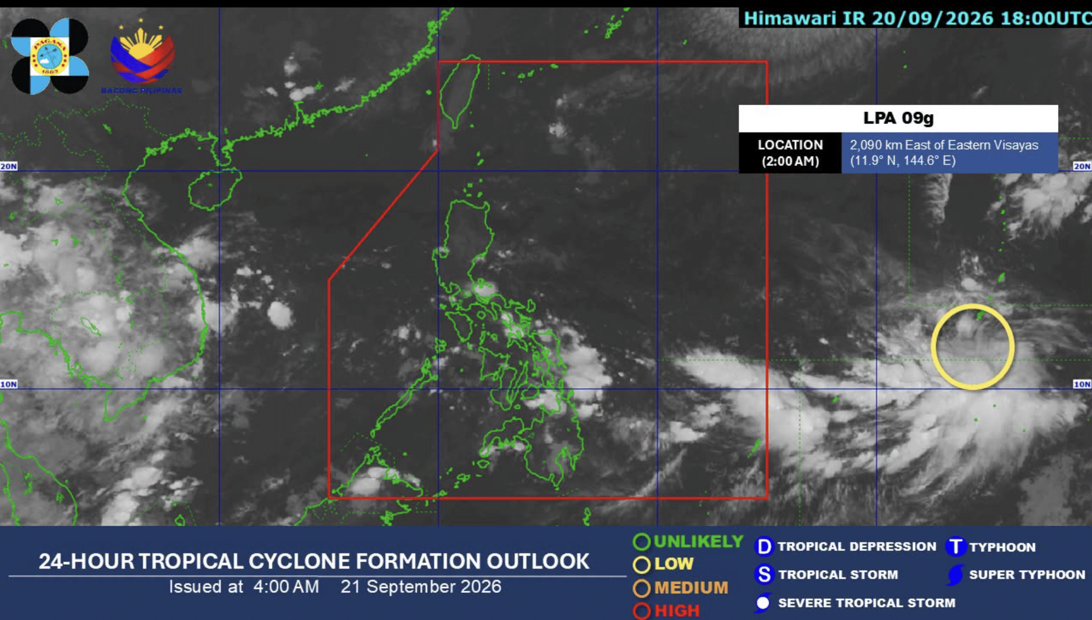
The Philippine Atmospheric, Geophysical and Astronomical Services Administration (Pagasa) forecasts a low pressure area (LPA) to enter the Philippine Area of Responsibility by midweek and potentially intensify into a tropical depression by the weekend. Moist winds from the South China Sea are also expected to persist.
A low pressure area (LPA) expected to enter the Philippine Area of Responsibility (PAR) by midweek may develop into a tropical depression by the weekend, the Philippine Atmospheric, Geophysical and Astronomical Services Administration (Pagasa) announced on Monday. In its 5 a.m. weather forecast, Pagasa stated that the LPA could intensify into a tropical depression by Thursday or Friday. Furthermore, the prevailing "Habagat" (monsoon winds) from the South China Sea are also expected to persist, bringing continued rains to various parts of the Philippines. The Habagat is a seasonal wind that significantly impacts the country's weather, especially during the rainy season, and its combination with an approaching low pressure system can lead to widespread adverse weather conditions. The Philippines is situated along the path of tropical cyclones and typhoons, experiencing numerous weather-related disasters annually. During the rainy season, the influence of Habagat increases the risk of storm surges in coastal areas, as well as flooding and landslides in inland regions. This forecast of the LPA's potential development signals the full onset of the typhoon season in the Philippines, prompting authorities to issue warnings and calls for vigilance. Concerns are being raised regarding potential impacts on daily life, infrastructure damage, and the agricultural sector.
Original source
Inquirer NewsInfo