General articles are free for 24 hours after publish.
Dong Nai Province Hit by Severe Flooding After Heavy Rains, Motorcycles Washed Away
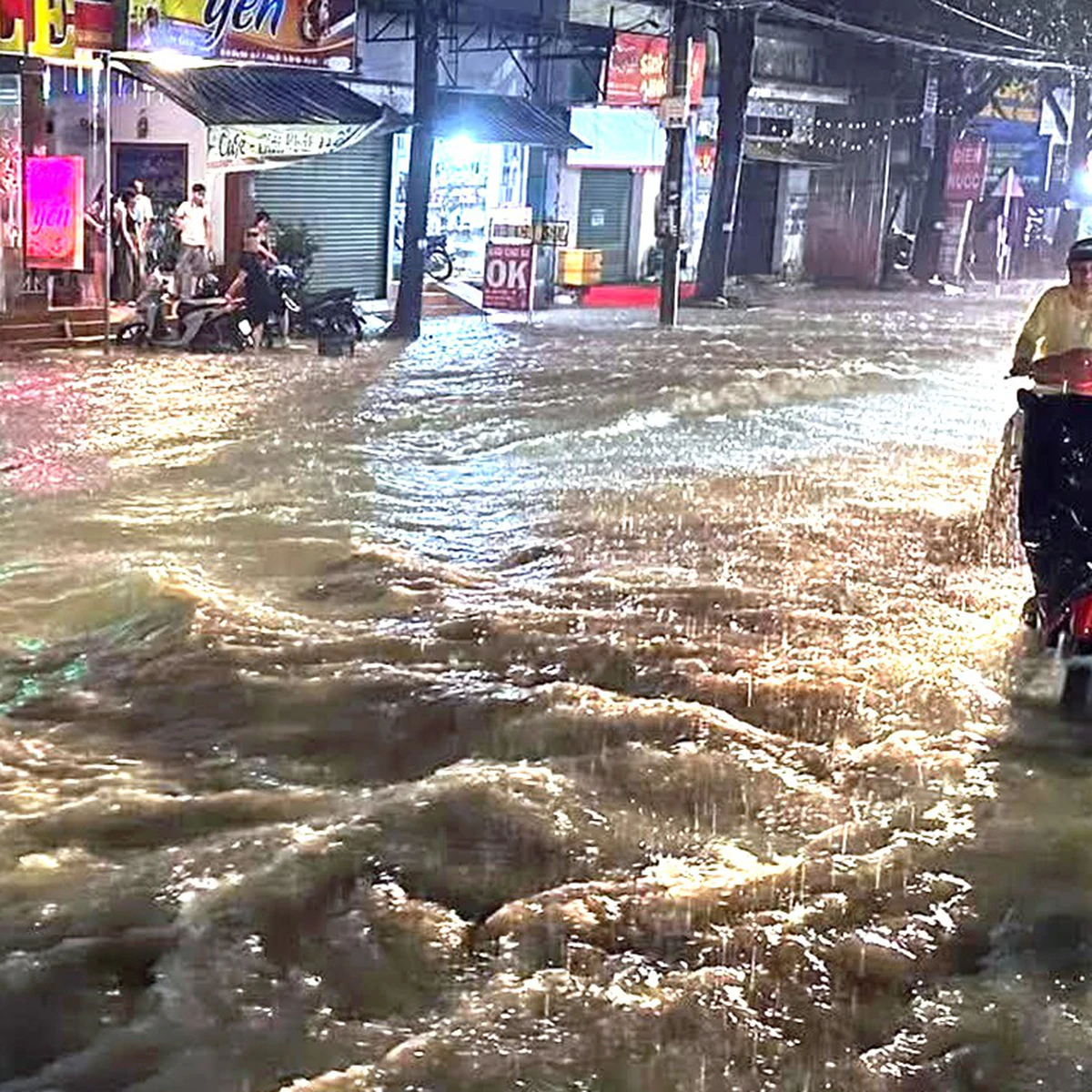
Severe localized downpours on the evening of September 10th caused widespread flooding across several major roads in Vietnam's southern Dong Nai Province, leading to incidents like motorcycles being swept away. Meteorological authorities have warned of saturated soil in some areas, raising concerns about potential landslides and infrastructure damage from continued rainfall.
On the evening of September 10th, localized heavy rainfall hit several areas in Vietnam's southern Dong Nai Province, causing widespread flooding on major roads including Dong Khoi, DT768, and National Highway 1. In the Trang Dai ward of Dong Nai City, water from residential areas inundated Dong Khoi street after a prolonged downpour, leading to traffic congestion and stalled motorcycles. Near Trang Dai market, a steeply sloped residential road experienced flooding exceeding half a wheel's height, with water flowing like a waterfall and sweeping away motorcycles. Many residents were forced to take alternative routes. In Long Khanh City, streets such as Ho Thi Huong, Tran Phu, and April 9th also saw localized flooding, with water depths in some areas exceeding 30cm, making vehicle movement difficult. In Xuan Loc ward, some residential roads and National Highway 1 experienced localized flooding, though traffic remained passable. Notably, in Phuoc Tan ward, approximately 100 households in Huong Phuoc neighborhood were flooded due to water overflowing from the upstream Buong River. Some residents living near the stream expressed fear and sought temporary lodging overnight, awaiting the water to recede. According to the Dong Nai Provincial Hydro-Meteorological Station, over the past 12 hours (from 7 AM to 7 PM), many areas across the province received moderate to heavy rainfall, with some experiencing very heavy downpours. The highest rainfall recorded was 80mm in Binh Son (Long Thanh ward), followed by Loc Ninh at 73mm, Bu Dang at 66mm, and Nghia Trung and Bom Bo both at 61mm, with the Bien Hoa meteorological station recording 52mm. The Dong Nai meteorological agency warned that soil moisture models indicate some areas in the city have reached near saturation (over 80%) or are fully saturated. In conditions of continued rainfall, the risk of flash floods, landslides, and land subsidence is elevated in certain areas. These phenomena could cause loss of life and property, lead to localized traffic disruptions, and affect civilian infrastructure and the livelihoods of residents. Under Vietnam's one-party system, infrastructure development is often state-led. However, the increasing frequency of extreme weather events due to climate change can pose challenges exceeding initial planning assumptions. Coastal and low-lying areas, particularly those experiencing rapid economic growth, are often more vulnerable to such natural disasters. While relations with China remain crucial for economic development, domestic infrastructure and disaster preparedness are vital for ensuring the stability of citizens' lives.
Original source
The Saigon Times