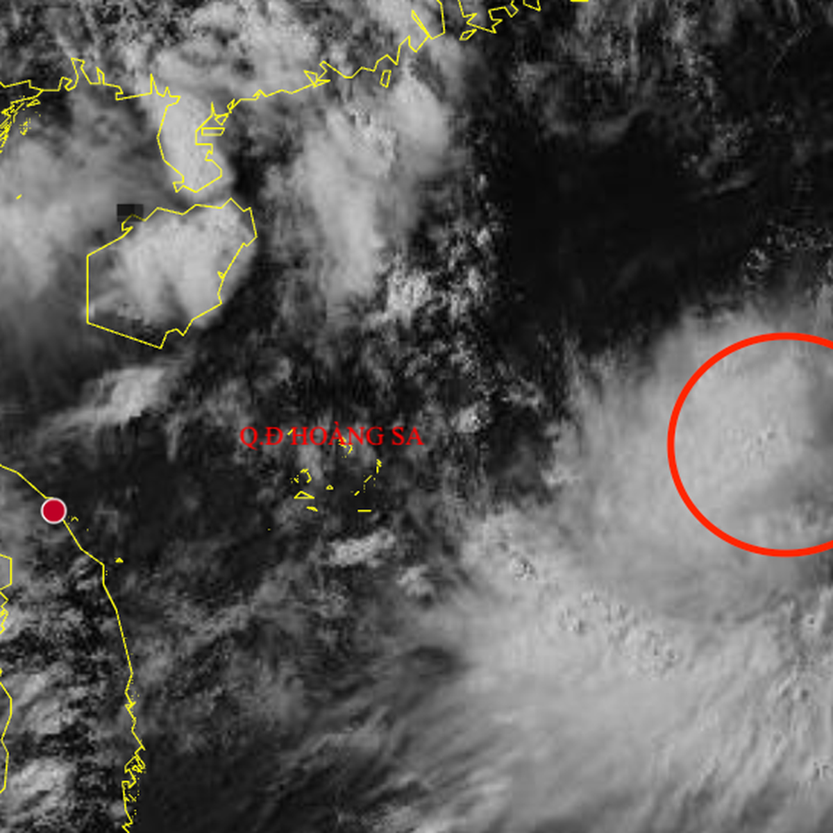
Tropical Depression Forms in East Sea, Northern Vietnam Braces for Heavy Rainfall
Diplomacy
2026年8月4日
5
The Saigon Times
Relations
🇻🇳Vietnam🇨🇳China

General articles are free for 24 hours after publish.

Tropical Depression Forms in East Sea, Northern Vietnam Braces for Heavy Rainfall

Share
AI Summary

Vietnam's National Center for Hydro-Meteorological Forecasting announced the formation of a tropical depression in the East Sea. The system is expected to bring heavy rainfall to northern and north-central regions, prompting warnings for potential flooding and landslides.

Vietnam's National Center for Hydro-Meteorological Forecasting announced on the morning of August 4th that a tropical low-pressure system in the northeastern waters of the East Sea has intensified into a tropical depression. As of 1 PM on the same day, the strongest winds near the center of the tropical depression were recorded at level 6 (39-49 km/h), with gusts up to level 8. Forecasts indicate that the tropical depression will move slowly eastward during the evening and night of August 4th, with its intensity expected to remain largely unchanged. By 1 AM on August 5th, the center is predicted to be located in the southeastern part of the northeastern East Sea, maintaining level 6 winds with gusts up to level 8. Furthermore, from the morning to noon on August 5th, the tropical depression is projected to move southeast at approximately 10 km/h, making landfall on the island of Luzon in the Philippines and subsequently weakening into a low-pressure area. "Due to the influence of the tropical depression, from the afternoon to the night of August 4th, the southeastern part of the northeastern North Sea will experience level 6 winds, gusts up to level 8, and waves of 2-3 meters, causing rough seas. Vessels operating in these dangerous areas are likely to be affected by thunderstorms, tornadoes, strong winds, and large waves. However, the tropical depression is not expected to directly impact Vietnam's coastal areas and mainland," stated the meteorological agency. Concurrently, the agency predicts that due to the influence of a low-pressure trough connected to a low-pressure vortex at higher atmospheric levels, northern and north-central regions of Vietnam will experience moderate to heavy rainfall and thunderstorms from the afternoon of August 4th to the night of August 5th. The rainfall is expected to range from 70-140mm, with localized areas potentially exceeding 200mm. During the day and night of August 6th, northern and north-central regions will continue to receive moderate to heavy rainfall, with amounts generally between 30-60mm, and localized areas experiencing over 100mm. The total rainfall from the afternoon of August 4th to the night of August 6th is estimated to be between 100-200mm, with some areas potentially exceeding 300mm. Residents are urged to be vigilant against localized heavy rainfall exceeding 100mm within a 3-hour period, which could lead to flooding in low-lying areas, urban centers, industrial zones, flash floods in small rivers and streams, and landslides in mountainous regions. The forecast for heavy rainfall in northern Vietnam (including Hanoi) and the provinces from Thanh Hoa to Ha Tinh, with some areas receiving over 300mm, is expected to continue from the afternoon of August 4th. Under Vietnam's one-party system, state agencies centralize meteorological information for public dissemination. The anticipated heavy rainfall from this tropical depression raises concerns about infrastructure impact and potential disruptions to agricultural production, amidst Vietnam's ongoing economic growth. Particularly, in the context of complex relations with China, the nation's capacity to respond to natural disasters is a factor that could influence its overall stability. Source: The Saigon Times

0

Original source

The Saigon Times

原文を読む