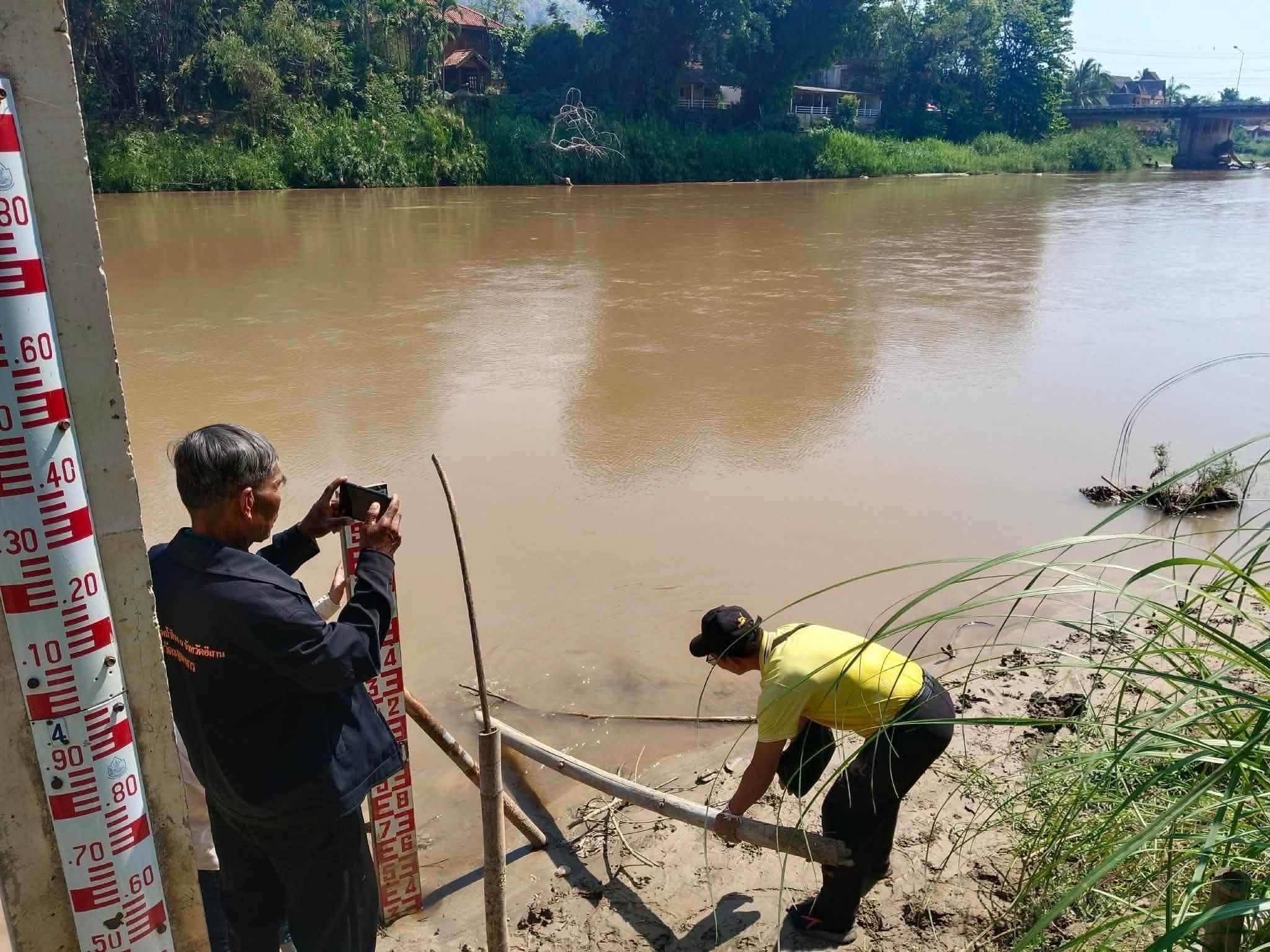
Kok River Communities in Chiang Rai Install Water Level Monitoring System
Communities along Chiang Rai's Kok River have implemented a community-led water level monitoring and early warning system to combat potential floods and landslides. Experts and residents are collaborating to ensure rapid information sharing and evacuation planning.
CHIANG RAI – Communities along the Kok River in Chiang Rai are enhancing their preparedness for the upcoming rainy season by installing a water level monitoring system. This initiative, organized by the Hill Area and Community Development Foundation (HADF) and formalized in a meeting on July 11, 2026, aims to mitigate the risks of floods and landslides. The collaborative effort involves government officials, academics, and local leaders who are analyzing water data and weather trends. The goal is to build a community-led early warning system that empowers villagers to actively track river changes and make swift emergency decisions. Currently, seven at-risk communities, spanning from Tha Ton in Chiang Mai province to Mae Yao in Chiang Rai, have had special water measuring poles installed. Key villages benefiting from this system include Rom Thai, Mai Mok Cham, and Pha Tai. Mae Yao Mayor Akkarapong Chalermliamthong recounted the devastating floods that struck the region in 2024 and the severe water contamination in 2025, suspected to be linked to cross-border mining activities. Many residents depend on the Kok River for sustenance and livelihood, but contamination fears have deterred fishing and swimming. Compounding these issues, early signs of drought are affecting crop planting, while the threat of sudden floods remains. Dr. Daoheuang Kaeochan from Rajamangala University of Technology Lanna presented new data on floodwater speed along the Kok River, which is crucial for calculating warning times for vulnerable villages. For instance, water travels from Rom Thai to Tha Ton in a mere 12 to 18 minutes, necessitating the use of satellite rainfall data for timely alerts. Water takes approximately two hours to reach Mae Na Wang. At Mae Na Wang, a five-meter water level triggers a basic watch alert, rising to 6.5 meters signifies flooding, and 7.5 meters indicates a severe disaster. Downstream villages like Pha Tai have about ten hours to prepare and evacuate safely. Takeo Toyota from the Highland Peoples Development Foundation proposed a customized, color-coded warning system where communities themselves define alert levels based on their historical flood experiences. He also encouraged the use of modern tools like the Windy app, while emphasizing the need for proper training to interpret satellite data. Tuenjai Deetes, a former senator and founder of HADF, highlighted the importance of restoring the upstream ecosystem, advocating for nature-based solutions like planting diverse, deep-rooted trees to absorb water and prevent landslides. She criticized current hillside farming practices for damaging the river and urged the government to promote diverse crops over short-term monoculture. Finally, Tha Luk Village Head Kotchamon Thepsommut pointed out a critical flaw in existing disaster plans: the unreliability of cell phone signals during severe weather. She called on local governments to provide backup radios and additional rescue equipment to ensure public safety. Source: Chiang Rai Times
多角的分析
コーク川流域における水位監視システムの導入は、地域経済の安定化に寄与する。過去の洪水や水質汚染は、漁業や農業といった地域住民の主要な収入源に深刻な打撃を与えてきた。早期警報システムは、これらの被害を最小限に抑え、経済活動の継続性を高める。また、自然災害への対応能力向上は、地域への投資リスクを低減させる可能性もある。
この水位監視システムの導入は、長期的な視点で見れば、タイ北部のインフラ開発への信頼を高める要素となり得る。自然災害リスクの低減は、地域経済の安定化につながり、潜在的な投資機会を創出する可能性がある。しかし、短期的な投資判断に直接的な影響を与えるほどではない。むしろ、持続可能な開発への取り組みとして、ESG投資の観点から注目されるかもしれない。
コーク川流域のコミュニティは、自然災害と水質汚染という二重の脅威に直面している。水位監視システムの導入は、住民の安全確保と情報共有の促進に不可欠である。特に、携帯電話の通信障害といったインフラの脆弱性は、災害時の情報伝達を困難にする。このシステムは、地域住民が主体的に参加することで、コミュニティのレジリエンス(回復力)を高め、災害に対する意識向上と連帯感を醸成するだろう。
チェンライ県コーク川流域の住民は、過去の洪水や水質汚染の経験から、自然災害への不安を抱えている。水位監視システムの導入は、自分たちの生活を守るための具体的な一歩となる。特に、迅速な情報共有と避難計画の策定は、住民の生命と財産を守る上で極めて重要である。しかし、携帯電話の通信障害といった問題が解決されない限り、完全な安心は得られないだろう。
背景・歴史的文脈
タイ北部は、古くから河川流域を中心にコミュニティが形成され、農業や漁業が主要産業となってきた。しかし、近年、気候変動による異常気象の頻発や、国境を越えた鉱業活動による環境負荷の増大が、地域住民の生活基盤を脅かしている。特に2024年の大規模洪水や2025年の水質汚染は、その深刻さを浮き彫りにした。こうした背景から、地域住民と専門家が連携し、自助・共助による災害対策システムを構築する動きが活発化している。
原文ソース
Chiang Rai Times