General articles are free for 24 hours after publish.
Rain to continue next week, Bago River water reaches Yangon-Bago road, some rivers exceed warning levels
With the strengthening of the monsoon and the development of cumulonimbus clouds, it is possible that it will continue to rain in many regions and states next week, and some rivers may exceed warning levels and continue
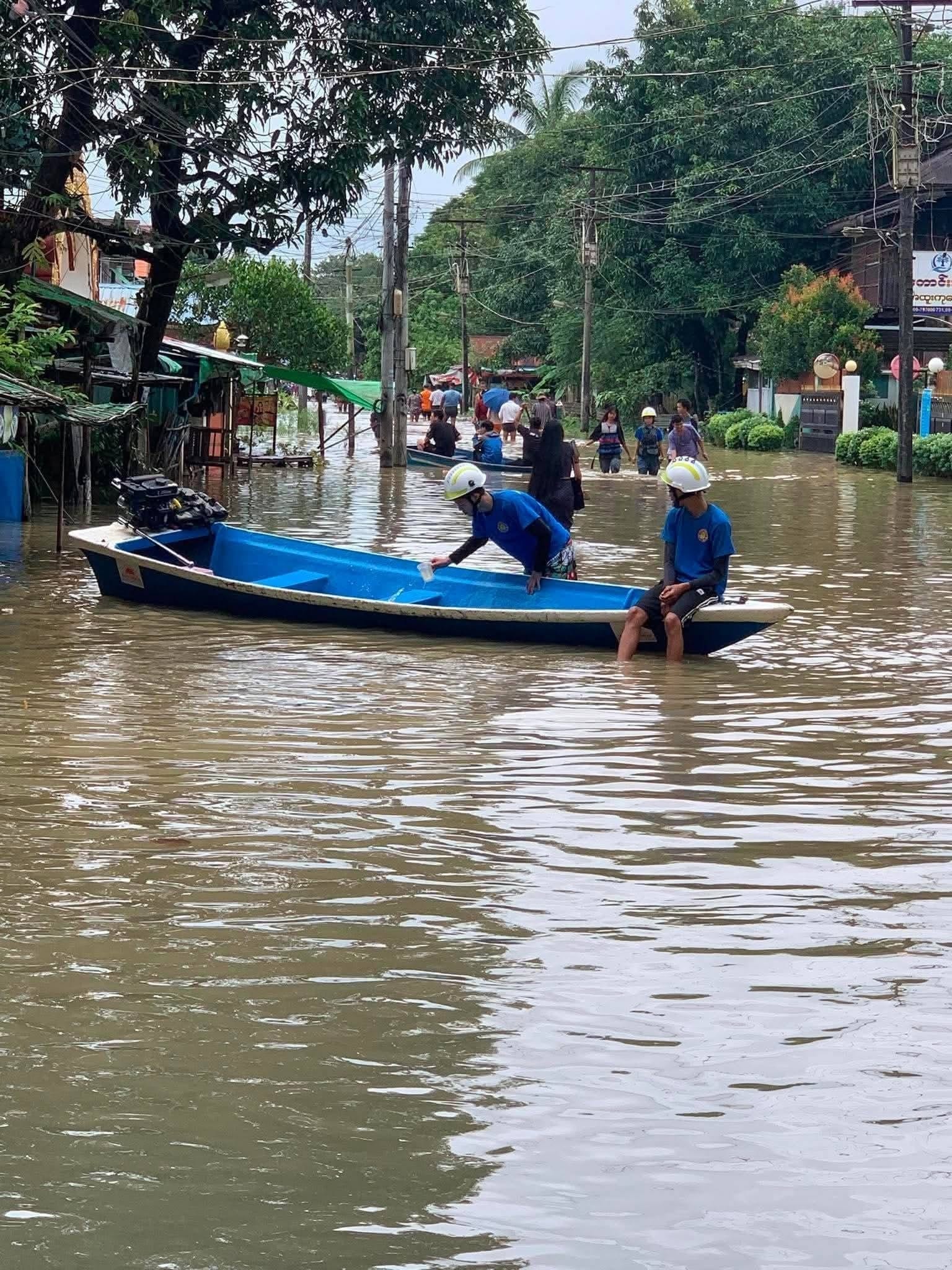
With the strengthening of the monsoon and the development of cumulonimbus clouds, it is possible that it will continue to rain in many regions and states next week, and some rivers may exceed warning levels and continue to rise, according to the Department of Meteorology and Hydrology (Meteorology/Hydrology) released today, September 2nd. It has been learned from social assistance workers that the Bago River water has reached the Yangon-Bago highway since this morning, and water has entered low-lying residential wards. The Bago River water has exceeded the warning level of 880 centimeters in Bago city and reached 917 centimeters, and it is possible that it will rise by about 1 foot in the next day and continue to remain above the warning level. "Water is entering the Zai Taung area. In low-lying areas, the water is knee-deep. It's just a little water entering due to the river's rise, and it's not yet severely flooded. It's not as bad as the floods of the past two years. If it continues to rain, I think the road that is currently flooded will be submerged," a local resident of Bago city told the Ayeyarwaddy Times. It is known that from September 1st to 6th, thunderstorms will occur in many places across the regions and states, and heavy rains may occur in some areas in the upper Sagaing region, Tanintharyi region, Kachin state, Karen state, Chin state, Mon state, Rakhine state, and Shan state (southern and eastern parts). The Meteorology/Hydrology Department has warned that due to heavy rainfall, strong winds, flash floods, and landslides may occur, and residents living near high ground and near small rivers and streams should take special precautions. The Chin Dwin River water will rise by about 3 feet 4 inches in Monywa city within the next day and reach the warning level. Furthermore, in Monywa city, it is about 4 feet 10 inches below the warning level, and it is possible to reach the warning level within the next 2 days. The Myittha River water is about 4 feet 5 inches below the warning level in Kalay city and may reach the warning level within the next day. In Hpa-an city, Karen state, the Salween River water has reached 863 centimeters from the warning level of 750 centimeters, and it may drop by about 3 inches in the next day, but it will continue to remain above the warning level, according to the Meteorology/Hydrology Department. The Madauk River water in Bago region will drop by about 6 inches in Madauk city within the next day and will continue to remain above the warning level, while the Shwegyin River water will fall back below the warning level in Shwegyin city within the next day, it is known. Along the Myanmar coast and offshore sea areas, occasional squalls and rough seas are expected, with wind speeds on the sea surface/land reaching up to 30 miles per hour. The wave height may reach 10 to 12 feet, according to the Meteorology/Hydrology Department's announcement. Photo – Meteorology/Hydrology Department, Social Assistance Team
Original source
Ayeyarwaddy Times