Pattaya and Eastern Coast Face Storm Threat as Monsoon Sends Waves Soaring
Environment
2026年7月13日
4
Pattaya Mail

Pattaya and Eastern Coast Face Storm Threat as Monsoon Sends Waves Soaring

AI サマリー

Thailand's Meteorological Department has issued a warning for strong winds, heavy rain, and rough seas from July 12-15 due to a strengthening southwest monsoon. Pattaya and the eastern coast are urged to monitor conditions closely for high waves and potential flash floods.

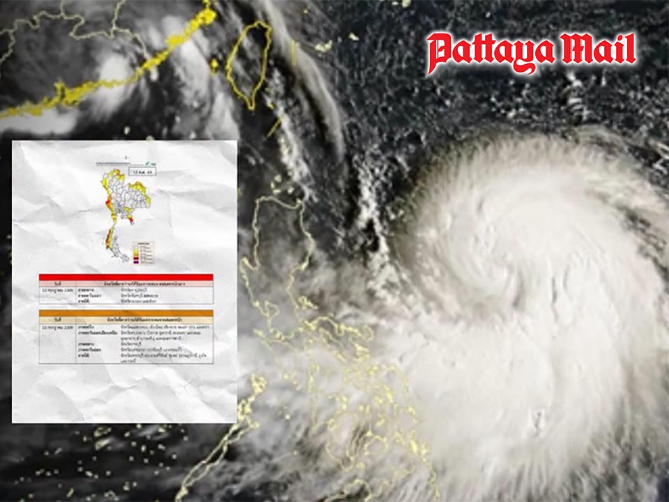
PATTAYA, Thailand – The Meteorological Department has issued a weather warning for strong winds, heavy rain and rough seas as a powerful southwest monsoon continues to affect Thailand from July 12–15. Pattaya and other areas along the Eastern coast are being urged to monitor conditions closely as the strengthening monsoon brings increased rainfall and rougher seas. The warning, issued on July 12, said the southwest monsoon covering the Andaman Sea, Thailand and the upper Gulf of Thailand has strengthened, causing dangerous sea conditions and heavy rainfall in several areas. (adsbygoogle = window.adsbygoogle || []).push({}); Waves in the upper Andaman Sea are expected to reach 2–4 metres, with waves higher than 4 metres possible during thunderstorms. The lower Andaman Sea and upper Gulf of Thailand may experience waves of 2–3 metres, increasing above 3 metres in areas affected by storms. The Meteorological Department advised fishermen and boat operators in both the Andaman Sea and Gulf of Thailand to exercise extreme caution and avoid sailing during thunderstorms. Small boats are advised to remain ashore during the warning period. Heavy to very heavy rainfall is expected in parts of southern Thailand’s western coast, western Central Thailand and the eastern region from July 12–14. Eastern provinces including Chanthaburi and Trat are among areas expected to experience the greatest impact, while Pattaya and Chonburi residents are advised to remain alert for changing weather conditions, heavy showers and rough seas. (function(w,q){w[q]=w[q]||[];w[q].push(["_mgc.load"]})(window,"_mgq"); Five provinces — Kanchanaburi, Chanthaburi, Trat, Ranong and Phang Nga — have been placed under a red alert for possible heavy rainfall. Residents in these areas are warned to watch for flash floods and forest runoff, especially those living near foothills, waterways and low-lying areas. The department also warned that accumulated rainfall could increase the risk of sudden flooding, particularly in areas with poor drainage or near rivers and streams. Meanwhile, Typhoon Bavi has already made landfall in Zhejiang Province, China. The storm is expected to weaken into a tropical storm and then a depression. Although Bavi will not move into Thailand and will not directly affect the country, it is strengthening the southwest monsoon, contributing to stronger winds and rainfall. Authorities urged residents, boat operators and travelers to monitor weather updates and plan activities carefully during the affected period. The public can follow updates from the Meteorological Department website or contact its 24-hour hotline at 1182.

多角的分析

経済的影響

南西モンスーンの強化は、タイの農業セクターに直接的な影響を与える可能性がある。特に東部沿岸地域は、農作物の収穫やインフラに被害をもたらすリスクがある。また、観光業、特に沿岸部のリゾート地では、悪天候によるキャンセルや観光客の減少が予想され、経済的損失につながる可能性がある。

投資家心理

短期的な視点では、悪天候は物流の遅延やインフラへの被害を通じて、一部の産業(建設、輸送)に投資リスクをもたらす。しかし、長期的な視点では、タイのインフラ整備(治水対策など)への投資機会を生み出す可能性もある。投資家は、気象予報や地域ごとの影響を注視し、リスク管理を徹底する必要がある。

社会的影響

パタヤやチャンタブリー、ラートなどの沿岸地域や河川沿いに住む住民は、鉄砲水や土砂流の危険に直面する。特に低所得者層やインフラ整備が遅れている地域では、被害が大きくなる可能性がある。また、漁業や小規模な観光業に依存するコミュニティでは、生計への影響が懸念される。

市民の声

タイ国民、特に東部沿岸地域や低地の住民は、日々の生活において直接的な影響を受ける。通勤・通学の遅延、交通網の寸断、農作物への被害による食料品価格の上昇などが懸念される。また、屋外での活動やレジャーが制限されることで、生活の質にも影響が出る可能性がある。

背景・歴史的文脈

タイにおける南西モンスーンは、毎年5月から10月にかけて雨季をもたらす季節風であり、国土の大部分に降雨を供給する重要な気象現象である。しかし、モンスーンの強さや期間は年によって変動し、時に激しい雨や強風、高波を引き起こし、洪水や土砂災害のリスクを高める。特に東部沿岸地域は、地形的に低地が多く、河川も集中しているため、モンスーンによる影響を受けやすい。過去にも、同様の気象現象により、インフラの損壊や農作物への被害、住民の避難といった事態が発生している。台風バビのような熱帯低気圧が、モンスーンをさらに強化させる要因となることもある。

原文ソース

Pattaya Mail

原文を読む