General articles are free for 24 hours after publish.
Tropical Depression to Enter PAR Thursday, Bring Rains to Four Areas
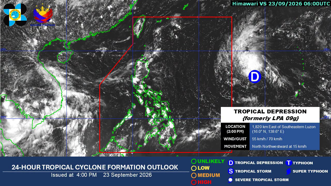
A tropical depression, to be named Queenie, is forecast to enter the Philippine Area of Responsibility (PAR) on Thursday, bringing rains to Eastern Visayas, Caraga, Davao Region, and Sarangani. It may intensify into a typhoon by the weekend but is not expected to make landfall.
A tropical depression is expected to enter the Philippine Area of Responsibility (PAR) on Thursday morning, as its trough is bringing rains over four areas, posing a risk of flooding and landslides, according to the Philippine Atmospheric, Geophysical and Astronomical Services Administration (PAGASA) on Wednesday. The tropical depression was last located 1,810 kilometers east of Southeastern Luzon and has maintained its strength, with maximum sustained winds of 55 kilometers per hour (kph) and gustiness of 70 kph, PAGASA said in its 4:00 p.m. weather forecast. It may intensify into a tropical storm and enter PAR, where it will be given the local name Queenie, the country’s 17th tropical cyclone this year. Queenie is then likely to intensify into a typhoon by the weekend but is not expected to make landfall anywhere in the country. “This tropical cyclone is not expected to directly affect the weather and sea conditions over the country in the next three days,” PAGASA said in its earlier 11:00 a.m. tropical cyclone advisory. However, its trough, or extension, is still forecast to bring thunderstorms over Eastern Visayas, Caraga, Davao Region, and Sarangani. PAGASA warned of possible flash floods and landslides due to moderate to occasionally heavy rains in these areas. Metro Manila and the rest of the country, meanwhile, are likely to experience localized thunderstorms. The bureau also warned of possible flooding and landslides. — Edg Adrian A. Eva
Original source
BusinessWorld Nation