General articles are free for 24 hours after publish.
Tropical Storm Pilandok Enhances Monsoon Outside PAR
Tropical Storm Pilandok (Krovanh) is moving eastward outside the Philippine Area of Responsibility but is enhancing the southwest monsoon, bringing rains to Luzon and the Visayas. Direct landfall is not anticipated.
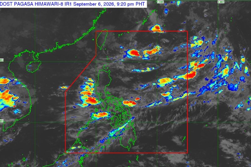
Tropical storm Pilandok (Krovanh) is enhancing the southwest monsoon or habagat, bringing rains to parts of Luzon and the Visayas, according to the Philippine Atmospheric, Geophysical and Astronomical Services Administration (PAGASA). The eye of Pilandok was last located 1,035 kilometers east-northeast of extreme northern Luzon as of 4 p.m. yesterday, based on the latest weather satellite imagery. It was packing winds of 65 kilometers per hour with gusts of 80 kph. Pilandok is moving eastward at 10 kph and is not expected to reenter the Philippine Area of Responsibility (PAR). However, it is heavily influencing the monsoon, bringing rains to many parts of Luzon and the Visayas in the coming days. Even when tropical storms do not make direct landfall in the Philippines, their proximity can significantly enhance the monsoon, affecting vast areas. This phenomenon is attributed to the Philippines' geographical location and its interaction with weather systems like the Pacific high-pressure area and equatorial systems. In this instance, Pilandok, situated in the Pacific east of the Philippines, is stimulating the monsoon and channeling moist air towards the mainland. Information Source: Philstar Nation
Original source
Philstar Nation