General articles are free for 24 hours after publish.
Northern Vietnam Faces Heatwave as Tropical Depression May Intensify into Typhoon No. 5
Vietnam's meteorological agency warns a tropical depression in the East Sea could intensify into Typhoon No. 5. Northern regions are forecast to experience intense heat from September 1st, raising concerns for public life.
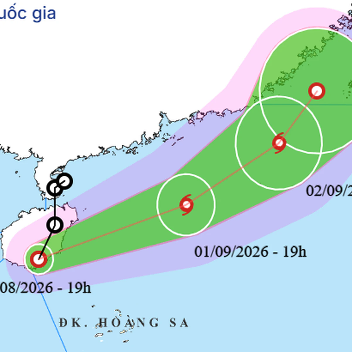
The National Center for Hydro-Meteorological Forecasting announced that as of 7 PM on August 31st, a tropical depression was located south of Hainan Island, China, maintaining an intensity of level 7 winds (50-61 km/h) with gusts up to level 9. This tropical depression is moving south at a speed of 15-20 km/h and is expected to pass through Hainan Island tonight and overnight before moving into the northern East Sea. Meteorological agencies predict a high probability of the tropical depression intensifying into Typhoon No. 5 around September 1st, which would be the fifth typhoon to form in the East Sea this year. Regarding its trajectory, it is highly likely that the typhoon will gradually change course from southeast to northeast tonight and tomorrow (September 1st), heading towards the Taiwan Strait and weakening. Due to the influence of the tropical depression, or potentially a typhoon, the northern East Sea region will experience strong winds of level 6-7 (gusts up to level 8-9), with wave heights reaching 2-4 meters. Near the storm's center, winds will reach level 8 (gusts up to level 10), with wave heights of 3-5 meters, indicating rough seas. Vessels operating in these dangerous areas are at risk of being affected by thunderstorms, squalls, strong winds, and large waves. For the latter half of the National Day holiday (September 1st-2nd), the latest forecast indicates that the northern region will experience intense heat earlier than previously predicted. Rainfall in the central region will also decrease from tomorrow, with heat returning on September 2nd. Conversely, the Central Highlands and southern regions will see increased rainfall due to the influence of the southwest monsoon. Specifically, in the northern region, from the night of August 31st to September 2nd, sunny conditions are expected, with some areas experiencing intense heat. Particularly on September 1st, intense heat, and in some places, extremely intense heat, is forecast. In the afternoon and evening, scattered showers and thunderstorms are anticipated. The lowest temperatures will range from 23-27°C, with some mountainous areas dropping below 23°C. The highest temperatures on September 1st will be between 33-36°C, with some exceeding 37°C, and on September 2nd, between 32-35°C, with some exceeding 35°C. In the Central region, from Ha Tinh to Da Nang, moderate to heavy rain with scattered thunderstorms is expected on the night of August 31st, with localized very heavy rainfall. From Quang Tri to Da Nang, scattered showers and thunderstorms are forecast for September 1st. Intense heat, with some areas experiencing very intense heat, is expected on September 2nd. For the South Central Coast, sunny days with some areas of intense heat are predicted, with scattered showers and thunderstorms in the afternoon and evening. The lowest temperatures will range from 24-28°C. The highest temperatures on September 1st will be between 31-34°C, and on September 2nd, between 34-37°C, with some exceeding 37°C. In the Central Highlands and southern regions, afternoon and evening will bring showers and scattered thunderstorms, with localized heavy rainfall. Showers and thunderstorms are expected to be few in the daytime. The lowest temperatures in the Central Highlands will be 21-24°C, and in the south, 24-27°C. The highest temperatures in the Central Highlands will be 27-30°C, and in the south, 31-34°C. For Hanoi, sunny days with some areas of intense heat are expected, particularly on September 1st. The lowest temperatures will range from 26-28°C, and the highest temperatures will be between 34-36°C, with some exceeding 36°C. Typhoon Saudel formed in the northwestern Pacific on August 19th. After crossing north of the Mariana Islands, it moved towards the southern islands of Japan before making landfall in Fujian Province, China, on August 28th. After entering mainland Fujian Province, the typhoon moved southeast towards Guangdong Province and weakened into a tropical depression and then a low-pressure area. By the morning of August 31st, this low-pressure area had moved to the northern East Sea and strengthened again into a tropical depression. Vietnam, a socialist republic under a one-party system, places significant governmental responsibility on responding to meteorological disasters. Forecasts for typhoon and tropical depression paths are critical information for the safety of coastal residents and fishermen. Furthermore, the onset of intense heat impacts industries reliant on outdoor work, such as agriculture and construction, while also increasing electricity demand and the need for heatstroke prevention measures. For Vietnam, a nation experiencing continuous economic growth, strengthening preparedness and response capabilities for natural disasters is a crucial aspect of sustainable development. In particular, given Vietnam's strong economic ties with China, the mechanisms for information sharing, including meteorological data, remain an area of focus. Source: The Saigon Times
Original source
The Saigon Times