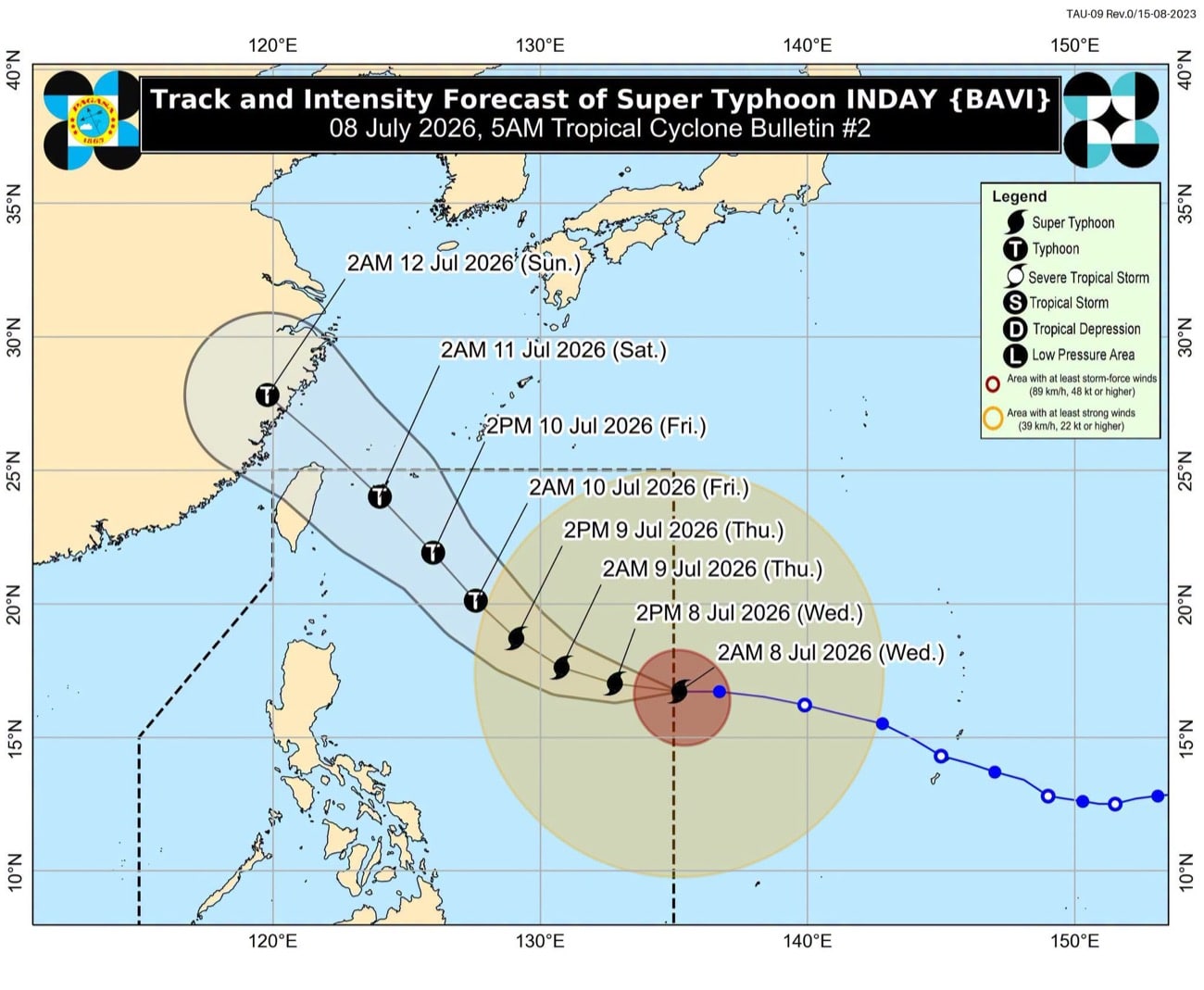
Super Typhoon Inday Enters PAR, Triggers Signal No. 1 in Northern Luzon
Super Typhoon Inday has entered the Philippine Area of Responsibility (PAR), prompting the hoisting of Wind Signal No. 1 in several areas of Northern Luzon. While direct impact is currently deemed limited, the enhanced southwest monsoon is expected to bring rain across various regions.
This article requires PRO
This article is outside the free access window or is a special report. PRO unlocks it and the full archive.
Related articles
- 35 Tourists Stranded in Batanes as Typhoon Inday Exits PH
Thirty-five tourists were stranded in Batanes province as flights were canceled due to Typhoon Inday's passage, with the storm heading towards Japan. Strong winds and high waves also affected 109 other passengers.
- Typhoon Inday exits PAR, heads toward China
Typhoon Inday (international name Bavi) exited the Philippine area of responsibility (PAR) on Saturday morning, according to the state weather bureau Pagasa. The typhoon is forecast to make landfall over mainland China.
- Typhoon Inday Exits PAR, Maintains Strength as it Moves Towards Japan
Typhoon Inday (international name: Bavi) has exited the Philippine Area of Responsibility (PAR), maintaining maximum sustained winds of 140 kph as it moves north-northwest. It is forecast to approach islands in southern Japan before making landfall in mainland China.
- Typhoon Inday maintains strength, Signal No. 2 over Northern Luzon
Typhoon Inday maintained its strength as it moved north-northwestward, with Tropical Cyclone Wind Signal No. 2 in effect over parts of Northern Luzon. Gale-force winds and heavy rainfall are expected, prompting advisories for coastal and upland areas.