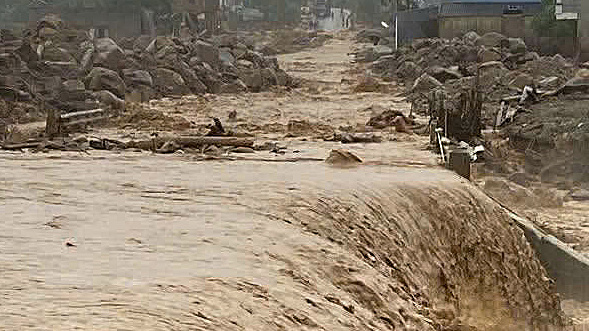
Vietnam's North Hit by Renewed Flooding Amid Heavy Rains, Hampering Recovery Efforts
Renewed flooding has struck Vietnam's northern Muong Than region, disrupting recovery efforts from a previous landslide on July 17. Muddy torrents carrying debris have inundated National Highway 32, prompting local authorities to warn residents and prohibit access to hazardous areas.
This article requires PRO
This article is outside the free access window or is a special report. PRO unlocks it and the full archive.
Related articles
- Vietnam's Central and Southern Regions Brace for Heavy Rains, Flood Risks in Urban Areas
Vietnam's central and southern regions are bracing for heavy rainfall from October 8th to 10th. Authorities are issuing warnings for potential flooding in urban and low-lying areas of Hue, Da Nang, and Ho Chi Minh City, as well as flash floods and landslides in mountainous regions.
- Ho Chi Minh City Grapples with Widespread Flooding and Traffic Chaos Amidst Heavy Rains
On the afternoon of October 7th, localized heavy rainfall in central Ho Chi Minh City spread across the entire urban area. Numerous main roads were submerged, causing severe traffic congestion during the evening rush hour and significantly impacting daily life.
- Rare White-naped Cranes Spotted Foraging in Yok Don National Park
A flock of rare White-naped Cranes has been sighted foraging in Vietnam's Yok Don National Park. This discovery highlights the park's rich biodiversity and the importance of ongoing conservation efforts.
- Da Nang City Prepares for Storms, Dispatches Forces to Vulnerable Areas
Da Nang City in central Vietnam has ordered its Military Command to deploy troops and equipment to critical areas in preparation for typhoons and heavy rains, prioritizing resident safety and damage mitigation.