General articles are free for 24 hours after publish.
West Kalimantan Peat Fires Intensify, Causing Severe Haze and School Closures
Peat fires in West Kalimantan are escalating, leading to widespread haze and impacting daily life, including temporary shifts to online learning in schools in Pontianak. Nine out of 14 regencies/cities in the province are affected, with peatland prevalence being a recurring issue.
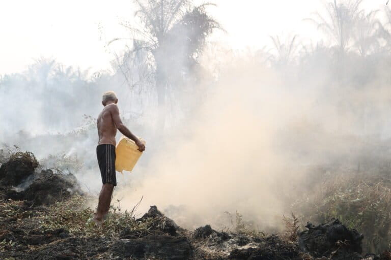
Forest and peatland fires in West Kalimantan, Indonesia, have worsened significantly since late last month, causing severe haze that is impacting daily life. As of the week of August 27th, schools in areas like Pontianak city have repeatedly switched to online learning due to deteriorating air quality. Daniel, the daily coordinator for the West Kalimantan Provincial Disaster Management Agency's (BPBD) Disaster Operations Control Center (Pusdalop), stated that 355 villages and sub-districts across 125 districts in the province are considered at risk for forest and land fires (karhutla). Nine out of the province's 14 regencies and cities are experiencing these fires, including Ketapang, Kubu Raya, Mempawah, Sambas, Sanggau, Kayong Utara, Melawi, Sintang, and Landak. "These areas are prone to fires because they have extensive peatlands, and the incidents consistently recur in the same locations," Daniel said on August 27th. The scale of karhutla has seen a sharp increase in recent months. The Peat Fire Monitoring System (SiPongi) recorded that the area of land fires in West Kalimantan reached 38,310.86 hectares from January to June 2026. As of August 27th, 2026, NASA-MODIS satellite data within SiPongi showed 225 hotspots across the province. High-confidence hotspots were concentrated in Ketapang (35 hotspots), Melawi (24), and Kapuas Hulu (5). In Dusun Maju Bersama, Desa Kalibandung, Kubu Raya, residents are seen attempting to extinguish the smoldering peat fires using jerrycans filled with water. Hayet, a resident of the hamlet, reported that fires began entering the village forest on July 27th and have since spread to areas managed by the community. Approximately 30 hectares of land managed by Hayet and his group are affected. Source: Mongabay Indonesia
Original source
Mongabay Indonesia