General articles are free for 24 hours after publish.
Thailand Water Level Data: Where to Check and How to Read It
Understanding Thailand's fluctuating water levels requires checking specific station data and understanding its context. Utilizing platforms like ThaiWater, alongside weather forecasts and official alerts, is crucial for effective disaster preparedness.
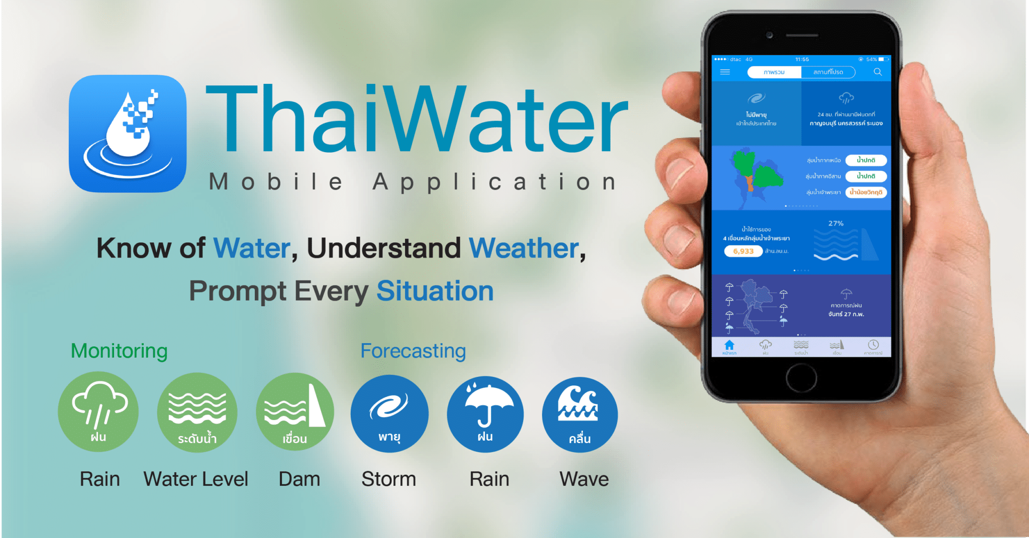
Understanding Thailand's fluctuating water levels requires checking specific station data and understanding its context. A river can rise while the street outside your hotel stays dry, or a road can flood before a nearby gauge looks alarming. Thai water level data can help you prepare, but one reading cannot describe conditions everywhere. Before changing travel plans or deciding whether to move belongings, check which station reported the level, when it was recorded, and what nearby warnings say. Start with the national view, then narrow your search to the places that affect you. Different sources answer different questions. Start with ThaiWater for a broad picture, then use the relevant agency for weather, water operations, or local instructions. The Hydro-Informatics Institute’s ThaiWater platform brings together river and canal levels, rainfall, reservoir storage, radar, and water-situation information. Its web dashboards and app present data through maps, tables, and graphs. The Hydro-Informatics Institute’s ThaiWater app description also describes national and provincial views. Search for the area you need, then open an individual station rather than relying on a map color alone. A station graph helps you see whether the latest level is part of a sustained rise or a brief change. The Royal Irrigation Department is useful for reservoir, canal, and irrigation-system information, including water-management operations. For incoming rain, check Thai Meteorological Department forecasts, rainfall information, and radar. The Department of Disaster Prevention and Mitigation (DDPM) issues emergency warnings. In Bangkok, Bangkok Metropolitan Administration updates can add local drainage and urban-flood information. Forecasts and alerts complement gauge readings: they address approaching weather and public safety, while a gauge reports conditions at its station. A number means little until you know what it measures. Before comparing two readings, confirm that their stations and measurement references match. Open the station details and locate it on the map. A reading at an upstream bridge isn’t a reading beside your hotel, even if both places lie on the same river. Next, check the observation time, not merely the time you opened the page. Read the unit and reference point as well. Some level pages show meters relative to mean sea level; another display may use a different reference. Reservoir pages may instead show stored volume in million cubic meters and a percentage of capacity. Those figures aren’t interchangeable with river height. Compare several updates at the same station. A steady rise matters more than an isolated number, especially when rain continues upstream. Nearby upstream stations and rainfall data can help explain what may be moving through the basin. Still, water doesn’t move identically through every stretch. Tributaries, drainage, and local conditions affect what happens farther along. Thai water level data can show a developing pattern without predicting flooding at every downstream location. A short cross-check is more useful than repeatedly refreshing one gauge. Keep the station’s location in mind as you move between maps and alerts. First, check the latest ThaiWater reading, its timestamp, and its recent graph. Next, review rainfall or radar and the Thai Meteorological Department forecast. Then look for DDPM warnings and updates from your province, municipality, or Bangkok authorities. For a local example, the Kok River water monitoring guide describes how communities use river observations alongside warning information. If you’re traveling, check conditions along your route as well as at your destination. Readings can arrive late, and gauges don’t cover every waterway. A river level also won’t tell you whether water has entered a particular street or made a road unsafe. If local authorities issue evacuation or travel instructions, follow them even when the nearest gauge appears unchanged. An official warning may account for rainfall, drainage problems, or conditions beyond that station’s view. It doesn’t prove the water level is safe or unsafe. The station may have a reporting problem, or data may not have arrived yet. Check another relevant source and current local alerts. Don’t assume they do. Read the timestamp on each station before comparing changes, especially during heavy rain. A newer upstream reading and an older downstream reading don’t describe the same moment. No. A forecast peak is an estimate of what could happen later; a gauge reading is an observation from a stated time. Keep both in view, but don’t treat the forecast number as water already at the station. Yes. ThaiWater has a mobile app as well as web dashboards; the ThaiWater App Store listing describes weather information and disaster notifications. Check the observation time in the app rather than assuming a freshly opened screen contains a fresh reading. Ask hotel staff, a local contact, or an authority to help confirm its location and instructions. A translation app can help you identify the message, but don’t rely on an uncertain translation for an evacuation decision. Thai water level data is most useful when you confirm the station, time, unit, and trend. Compare that picture with rainfall, forecasts, and official alerts before making plans. When conditions turn dangerous, follow local authority guidance. A single gauge cannot tell you whether the ground beneath your feet is safe.
Original source
Chiang Rai Times