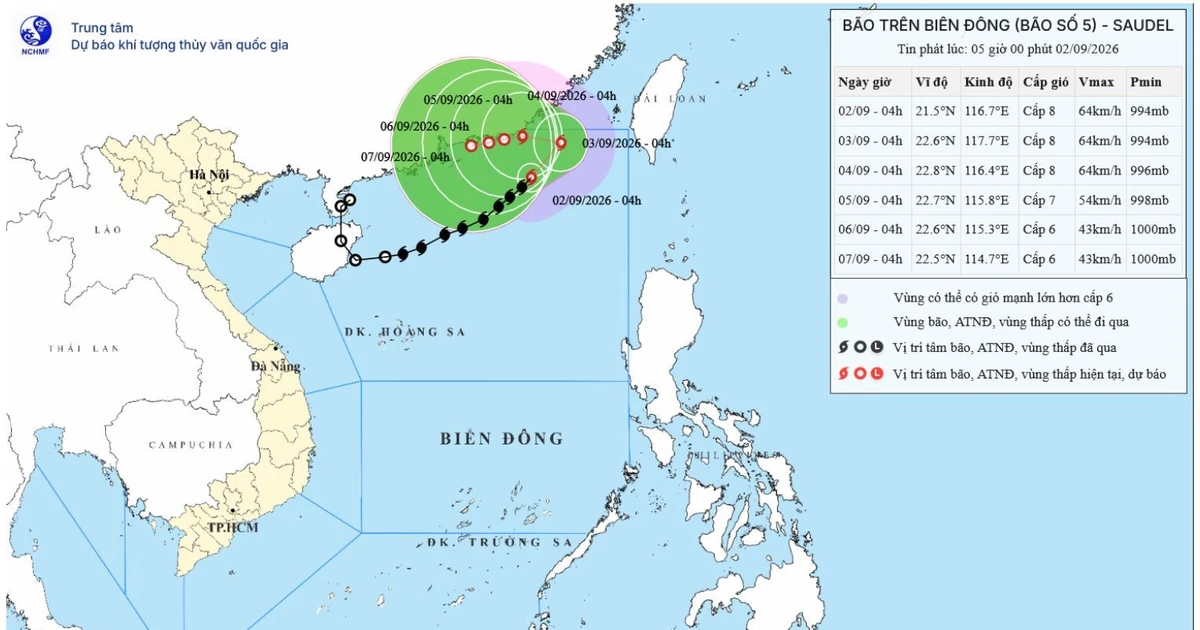
Typhoon No. 5 Approaches Northeast South China Sea, Hazard Level 3 Issued
Typhoon No. 5 has formed in the northeast South China Sea off Vietnam's coast, with maximum sustained winds of Force 8 (62-74 km/h) and gusts up to Force 10. It is forecast to weaken into a tropical depression by September 5th, but ships are warned of high waves and strong winds.
This article requires PRO
This article is outside the free access window or is a special report. PRO unlocks it and the full archive.
Related articles
- Heavy Rain Triggers Widespread Damage Across Central Vietnam
Record heavy rainfall has caused widespread damage across central Vietnam, triggering floods and landslides that have damaged homes and disrupted transportation networks. Authorities are urging vigilance.
- Central Vietnam Hit by Record Rainfall, Infrastructure Damaged; Northern Region Faces Cold Snap
Central Vietnam is experiencing record rainfall due to a rare, powerful cold front, causing widespread flooding, infrastructure damage, and property destruction. The northern region is facing a severe cold snap.
- Heavy Rains Cause Landslides in Hue, Vietnam, Injuring Two
Heavy rains in Vietnam's central city of Hue from November 8-11 caused severe landslides along river and coastal embankments. Two people were injured, prompting authorities to heighten vigilance.
- Vietnam's Rare Cold Snap: Experts Warn of 10-Year High Intensity, Torrential Rain, and Gale-Force Winds
Vietnam's first cold snap of the season is one of the strongest in a decade, according to meteorologists. The north is experiencing record low temperatures, while the central region is battered by typhoon-like heavy rain and strong winds, raising concerns about extreme weather patterns.