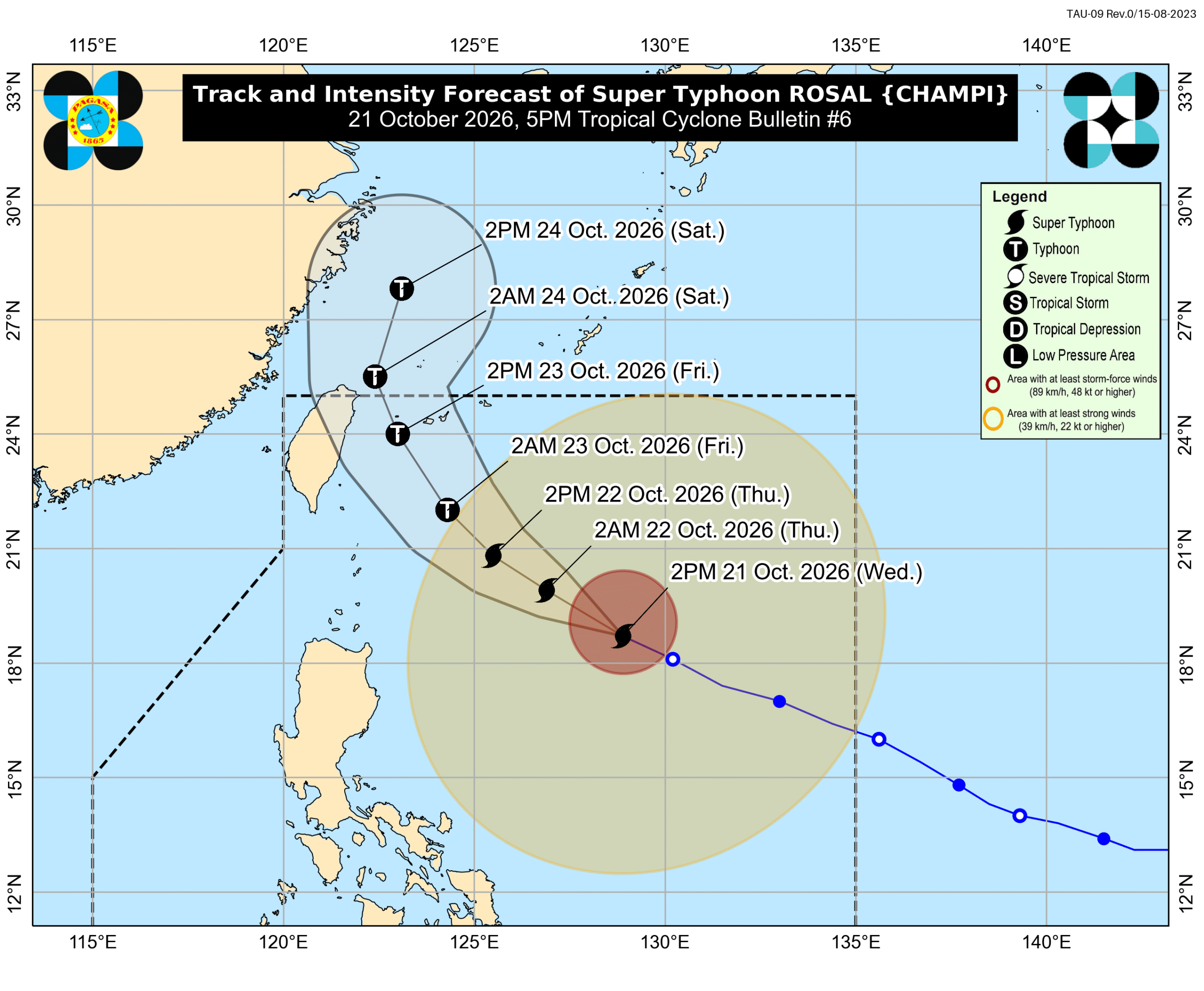
Super Typhoon Rosal Weakens, But Warnings Remain in Effect
Super Typhoon Rosal is weakening, but warnings for heavy rain and strong winds persist, especially in Northern Philippines. While landfall is not expected, coastal areas are cautioned against high waves.
Read up to 3 eligible full articles per Japan day (JST) for free
Create a free account to open up to 3 eligible full articles per Japan calendar day (JST). Headlines and summaries remain available across ASEAN 7.
Related articles
- Super Typhoon Rosal to Bring Heavy Rains, Gusty Winds to Northern, Southern Luzon
Super Typhoon Rosal (international name: Champi) is forecast to bring heavy rains and gusty winds to several areas in Northern and Southern Luzon from Wednesday to Friday, according to the Philippine Atmospheric, Geophysical and Astronomical Services Administration (Pagasa). Coastal areas should also watch for storm surges.
- Northeast Monsoon Expected Before End of October, Bringing Cooler Weather Amid El Niño
The Philippine Atmospheric, Geophysical and Astronomical Services Administration (PAGASA) anticipates the onset of the northeast monsoon, locally known as Hanging Amihan, before the end of October. This weather system is expected to bring cooler temperatures and rainfall to parts of the country amidst the ongoing El Niño phenomenon.
- Signal No. 2 Raised in Batanes as Super Typhoon Rosal Moves Away
The Philippine weather bureau has raised Tropical Cyclone Wind Signal (TCWS) No. 2 over Batanes as Super Typhoon Rosal moves away from northern Luzon. The typhoon is currently tracking northwest in the West Philippine Sea.
- Batanes Under Signal No. 2 as Super Typhoon Rosal Approaches
PAGASA has raised Tropical Cyclone Wind Signal No. 2 for Batanes as Super Typhoon Rosal maintains its strength over the sea east of Northern Luzon, with sustained winds of 215 kph and gusts up to 265 kph, posing a threat to life and property.