General articles are free for 24 hours after publish.
Tropical Low Forms in Tonkin Gulf, Typhoon Dolphin Nears Southern Japan
A tropical low has intensified into a tropical depression in the Tonkin Gulf, Vietnam. Meanwhile, Typhoon Dolphin is approaching southern Japan, including Kagoshima. These weather events may impact Vietnam's coast and the East Sea.
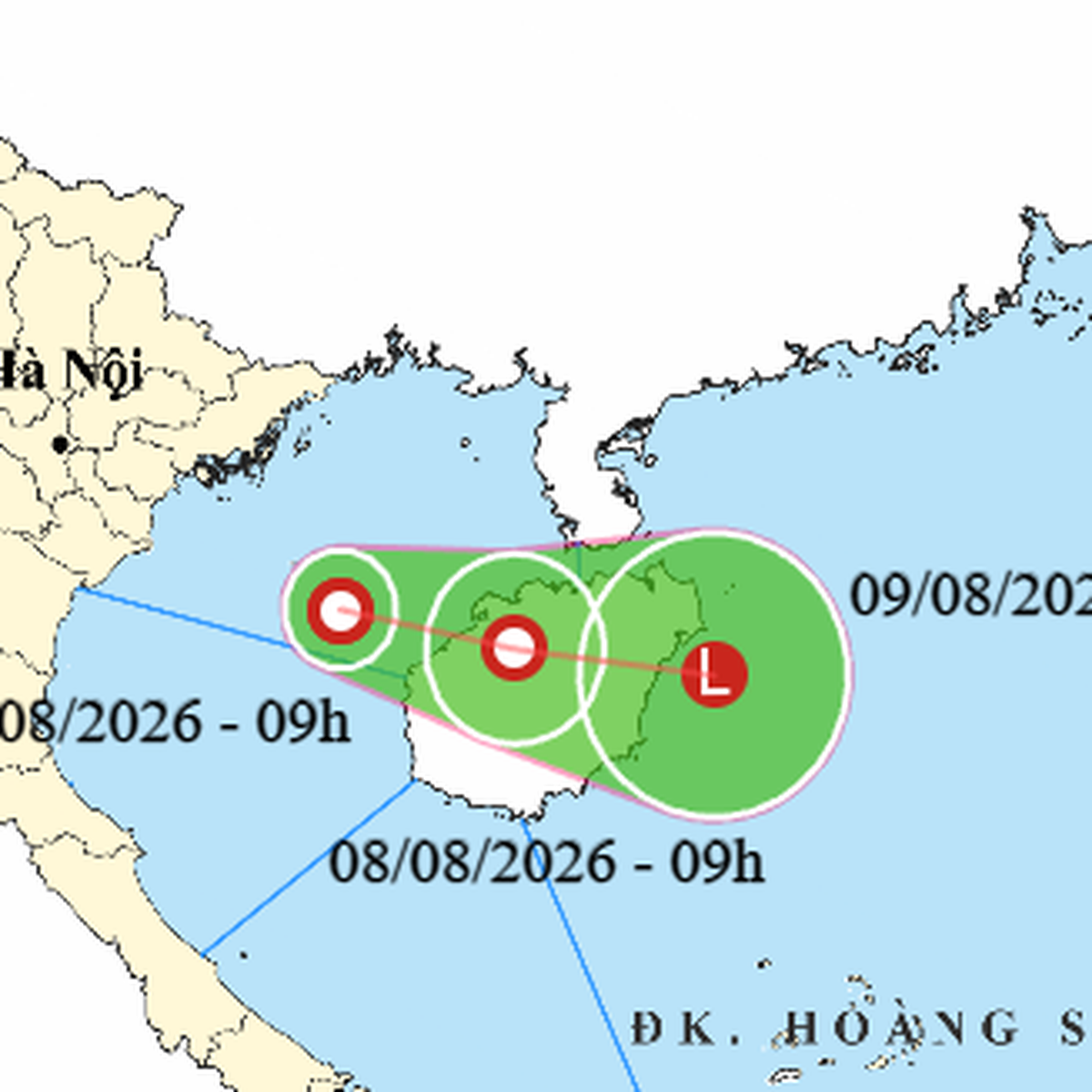
A tropical low that formed in the Tonkin Gulf has intensified into a tropical depression as of the morning of August 7. According to the National Center for Hydro-Meteorological Forecasting, at 9 AM, the center of the tropical depression was located in the waters southeast of Bach Long Vi Island, with the strongest winds near the center reaching level 6 (39-49 km/h), with gusts up to level 8. The tropical depression is forecast to move slowly eastward and southeastward at a speed of about 5 km/h, entering the northeast of Hainan Island, China, on August 8. It is then expected to move into the East Sea and weaken into a low-pressure area. Due to the influence of the tropical depression, the Tonkin Gulf will experience strong winds of level 6, with gusts up to level 8, and waves of 2-3 meters, leading to rough seas. Additionally, on August 7 and 8, the central East Sea, the waters from Gia Lai to Lam Dong provinces, the northern part of the southern East Sea (including the northern part of Truong Sa Islands), and the southern part of the northern East Sea (including Hoang Sa Islands) will also experience strong winds of level 6, with gusts up to level 8. Furthermore, heavy thunderstorms are expected in the southeastern part of the northern East Sea and the Tonkin Gulf, with scattered rain and thunderstorms in other sea areas. Vessels operating in these dangerous waters may be affected by thunderstorms, whirlwinds, strong winds, and high waves. Meanwhile, according to the Japan Meteorological Agency, as of 9 AM on August 7, Typhoon Dolphin is approaching the northern part of Okinawa and southern Kagoshima Prefecture, with maximum sustained winds near the center of approximately level 13 (140 km/h) and maximum gusts of level 16. Although the typhoon is weakening, its circulation spans a wide diameter of about 1,100-1,200 km, with strong winds of level 10 extending about 330 km to the northeast of the center and 180 km to the southwest. Winds of level 7 or higher extend about 650 km to the northeast and 560 km to the southwest. Japanese forecasts indicate that Typhoon Dolphin will gradually change course westward and head towards eastern China. It is possible that the typhoon will make landfall near Wenzhou City, Zhejiang Province, between the night of August 9 and the early morning of August 10, maintaining an intensity of level 13 with gusts of level 16 before landfall. Regarding Typhoon Chan-hom in the northwestern Pacific, as of the morning of August 7, it is maintaining an intensity of level 8-9 (62-88 km/h) with gusts of level 10. Forecasts suggest it will move northward and then northwestward towards Japan, with little possibility of further strengthening. Domestic weather forecasts in Vietnam predict that on August 7, northern Vietnam and the area from Thanh Hoa to Bac Quang Tri provinces will experience scattered showers and thunderstorms, with rainfall amounts of 15-30 mm, and localized heavy rain exceeding 80 mm. In the afternoon and evening, the Central Highlands and southern regions will also see scattered showers and thunderstorms with rainfall of 15-30 mm, and localized heavy rain exceeding 60 mm. These heavy rains could affect agricultural production, cause trees to fall, damage houses, and impact transportation infrastructure. Localized heavy rainfall may also trigger flash floods in small rivers, landslides on steep slopes, and flooding in low-lying areas. In the north, heavy rain in the morning is expected to gradually decrease in the afternoon. Source: The Saigon Times
Original source
The Saigon Times