General articles are free for 24 hours after publish.
Forest Fires Rage Across Indonesia, With Blazes Found in Corporate Concessions and Food Projects
An investigation by Indonesian environmental NGO WALHI reveals that many forest and peatland fires (Karhutla) are occurring within corporate concession areas and National Strategic Food Production Projects (PSN). This contradicts the government's narrative blaming local communities, with fires particularly widespread in Papua.
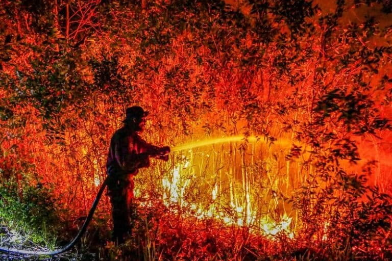
As forest and peatland fires (Karhutla) rage across Indonesia, a new investigation by environmental NGO Wahana Lingkungan Hidup Indonesia (WALHI) reveals that a significant portion of these blazes are occurring within corporate concession areas and government-backed National Strategic Projects (PSN), particularly those designated as 'food estates.' Boy Jerry Even Sembiring, Executive Director of WALHI National, stated that most of the fires spreading from Sumatra in the east to Kalimantan and Papua in the west are happening on land with corporate permits. This finding challenges the government's narrative, which often points to local communities as the primary cause of Karhutla. In Papua, fire hotspots have been identified even within food estate project areas, such as in Merauke Regency and the Papua Mountains Province. According to Maikel Primus Peuki, Director of WALHI Papua, the opening of approximately 2.5 million hectares of land for these government projects is linked to the increase in fire incidents. "Forest fires in Papua are becoming increasingly massive. Field verification shows that almost all hotspots are causing fires. This is a crucial issue for Papua," Peuki said. WALHI Papua's identification indicates that fires have been recurring for at least the past three years, directly impacting indigenous communities who rely heavily on forest ecosystems for their livelihoods. On Borneo Island, hotspots surged in August 2026. West Kalimantan Province recorded the highest number of hotspots in Indonesia during this period. From January to July 2026, 4,638 hotspots were scattered across 14 districts. In just the first 25 days of August, the number rose to 4,683. As of August 25, the total area affected by fires in West Kalimantan reached 38,310 hectares, with Ketapang Regency being the most severely impacted at 12,443 hectares. The majority of these fires are occurring within Hydrological Units of Peat (KHG) and are largely situated within business permit areas.
Original source
Mongabay Indonesia