General articles are free for 24 hours after publish.
Tropical Depression 'Queenie' to Enter PAR Thursday, May Intensify into Typhoon — PAGASA
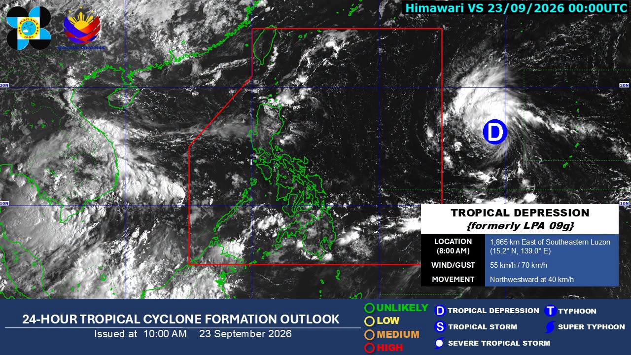
A tropical depression is forecast to enter the Philippine Area of Responsibility (PAR) on Thursday and may intensify into a typhoon, according to the Philippine Atmospheric, Geophysical and Astronomical Services Administration (PAGASA). The system, to be named 'Queenie', is expected to bring thunderstorms to several areas.
A tropical depression is expected to enter the Philippine Area of Responsibility (PAR) on Thursday and may intensify into a typhoon, according to the state weather bureau. The system will be given the local name 'Queenie'. Chenel Dominguez, a weather specialist at the Philippine Atmospheric, Geophysical and Astronomical Services Administration (PAGASA), stated during a press briefing that the tropical depression is anticipated to enter PAR on Thursday as a tropical storm. She also indicated that its highest projected category is that of a typhoon. The tropical depression was last observed 1,920 kilometers east of Southeastern Luzon, with maximum sustained winds of 55 kilometers per hour (kph) and gusts reaching up to 70 kph. Its trough is currently causing thunderstorms over Eastern Visayas, CARAGA, Davao Oriental, Misamis Oriental, and Camiguin. PAGASA has issued warnings for potential flooding and landslides in these areas during severe thunderstorms. The bureau also noted that the tropical depression is likely to enhance the southwest monsoon, but it is not expected to cause widespread rains similar to those experienced in early September. Generally fair weather is forecast for Metro Manila and the rest of Luzon, with a possibility of localized thunderstorms in the afternoon. Information Source: BusinessWorld Nation
Original source
BusinessWorld Nation