General articles are free for 24 hours after publish.
Super Typhoon Dolphin Expected to Bring Strong Winds to South China Sea
Super Typhoon Dolphin is not expected to make direct landfall in Vietnam, but may bring strong winds to parts of the South China Sea from August 5-7. Vietnamese meteorological agencies are urging caution.
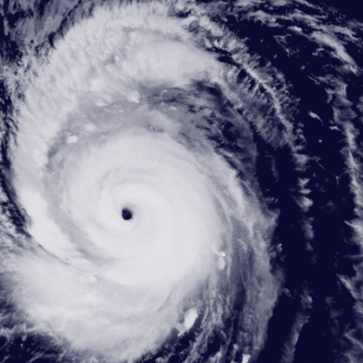
Super Typhoon Dolphin is not expected to make direct landfall in Vietnam, but is forecast to bring strong winds to parts of the South China Sea from August 5-7, according to the Vietnam National Center for Hydro-Meteorological Forecasting. As of the morning of August 1, the Japan Meteorological Agency (JMA) reported that the eye of Super Typhoon Dolphin was located off the coast of Luzon Island, Philippines. The maximum wind speed near the center was approximately 185 km/h (equivalent to level 16), with gusts up to 260 km/h (exceeding level 17). Satellite imagery clearly showed a well-defined, circular eye and extensive cumulonimbus clouds extending hundreds of kilometers. The JMA estimates that the strong wind zone (level 10 or higher) extends about 150 km from the center, while the zone with winds of level 7 or higher extends approximately 500 km to the northeast and 330 km to the southwest of the typhoon's center. JMA forecasts that Super Typhoon Dolphin will primarily move west-northwest then west, heading towards the waters east of China, with a possibility of further weakening. Meanwhile, Vietnamese meteorological agencies had previously predicted that Dolphin would move west-northwest at about 20 km/h in the next one to two days, with wind speeds near the center potentially strengthening further, exceeding level 17 and possibly equaling Super Typhoon Sinlaku in April 2026. However, from August 3rd, the typhoon is expected to change course from west-northwest to west, moving towards the Fujian-Zhejiang region of China at an average speed of about 25 km/h. The Vietnam National Center for Hydro-Meteorological Forecasting stated, "Around August 5th, as the typhoon approaches the waters north of Taiwan (China), the southwest monsoon over the southern South China Sea is expected to intensify. From August 6th to 7th, the southwest monsoon across most of the northern, central, and southern South China Sea (including the Paracel and Spratly Islands) could reach level 6-7, with wave heights of 2-4 meters, leading to very rough seas." The center is closely monitoring the developments of Super Typhoon Dolphin. Under Vietnam's one-party system, government response to natural disasters is a crucial responsibility. Timely and accurate information dissemination and warnings are vital for public safety. For Vietnam's continuously growing economy, the impact on infrastructure, fisheries, and maritime transport is significant, and typhoon information can indirectly affect economic activities. Furthermore, given the context of maritime claims in the South China Sea concerning China, weather information may also be viewed through a security lens. Source: The Saigon Times
Original source
The Saigon Times