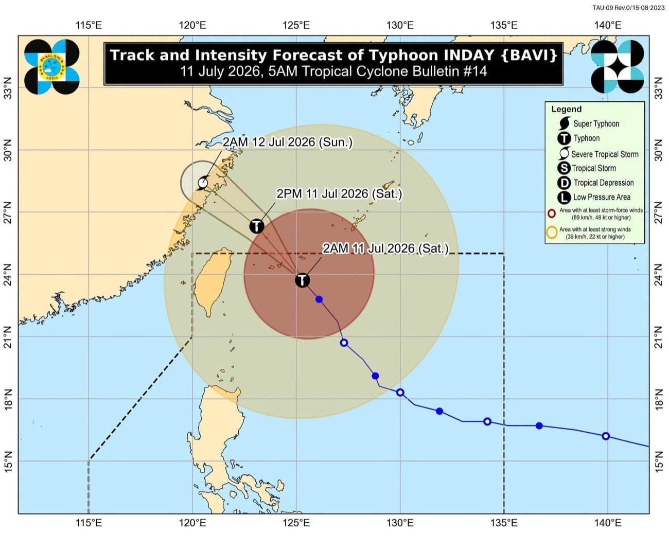
Typhoon Inday Approaches Japan, Batanes Under Signal No. 2
Typhoon Inday (international name Bavi) is approaching the Sakishima Islands in southern Japan, with Tropical Cyclone Wind Signal No. 2 issued for Itbayat, Batanes. The Philippine weather bureau forecasts Inday to make landfall in mainland China after passing Japan.
This article requires PRO
This article is outside the free access window or is a special report. PRO unlocks it and the full archive.
Related articles
- Multi-country remittances totaling P50 million flow into Duterte-linked firm, raising money laundering concerns
Nearly P50 million in remittances flowed into a food company linked to the husband of Philippine Vice President Sara Duterte, originating from eight countries besides China. Concerns have been raised due to some source countries' reputations for money laundering, prompting scrutiny of regulatory responses.
- Four Filipina Executives Named to Fortune's Asia Power List
Four Filipina executives have been recognized in Fortune Magazine's "100 Most Powerful Women in Asia" list. Martha Sazon, President and CEO of GCash, secured the highest rank at 35th, highlighting the growth of Philippine companies and the increasing influence of women leaders in the Asian economy.
- Philippines, Poland Deepen Defense Ties with Black Hawk Deal
The Philippines and Poland have agreed to further strengthen defense cooperation, spurred by the acquisition of Polish-made helicopters. The two nations also signed a mutual legal assistance agreement in criminal matters, aiming to deepen their relationship.
- AMLC exec: Firm linked to VP Sara's husband had P1.2 billion in covered, suspicious transactions
An executive from the Anti-Money Laundering Council (AMLC) testified that Cale88 Foods Corporation, a company linked to Vice President Sara Duterte's husband, Manse Carpio, had transactions exceeding P1.2 billion (approximately $20 million USD) from 2022 to 2025. These transactions fall under Covered Transaction Reports (CTRs) and Suspicious Transaction Reports (STRs).