General articles are free for 24 hours after publish.
Low-Pressure Area Forms in East Sea, Northern Vietnam Sees Sunny Skies While Central and Southern Regions Experience Heavy Rainfall
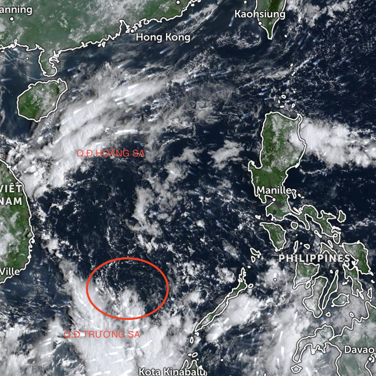
A new low-pressure area has formed in the East Sea, expected to bring widespread rain and thunderstorms in conjunction with the tropical convergence zone. While northern Vietnam will continue to experience sunny weather, central and southern regions are forecast to see localized heavy rainfall. Flood damage from previous downpours persists.
The National Center for Hydro-Meteorological Forecasting announced on September 18 that a low-pressure area has formed along the tropical convergence zone stretching from the central coast of Vietnam to the central East Sea. As of 1 PM today, this low-pressure system is located northwest of the Paracel Islands (Hoang Sa archipelago). Due to the influence of the tropical convergence zone combined with the low-pressure area, scattered showers and thunderstorms are forecast for the Northern Bay of Tonkin, sea areas from Quang Tri to Gia Lai, Khanh Hoa to Ca Mau, Ca Mau to An Giang, the Gulf of Thailand, the western part of the northern East Sea (including the Paracel Islands), the southern part of the central East Sea, and the southern East Sea (including the Spratly Islands) from the night of September 18 to September 19. During thunderstorms, there is a high possibility of tornadoes and strong gusts of wind reaching speeds of 60-70 km/h, with sea waves exceeding 2 meters. All vessels operating in these areas are at risk of being affected by tornadoes and strong winds. On land, the weather system that caused heavy rains in the North in recent days has moved away, and sunny skies are beginning to appear. Light rain may occur in the southern part of the Northern Delta tonight and early tomorrow morning, but it is not expected to be heavy. Sunny and dry weather will continue in the North from tomorrow onwards. Meanwhile, in the central and southern regions of Vietnam, rain is expected in many places. Particularly from the night of September 18 to tomorrow, Nghe An to Hue provinces will experience the most rainfall, with amounts generally between 30-60mm, and over 80mm in some locations. From the night of September 19, heavy rains in the North Central Coast region will gradually decrease. Satellite and weather radar imagery also shows strong development of cumulonimbus clouds in Lam Dong province and some southern areas. These areas are forecast to have moderate rainfall of 20-40mm in the evening and night today, with localized amounts exceeding 80mm. This period of rain in the Central Highlands and the Southern region is likely to last until September 22. Previous heavy rains and floods in the North, Thanh Hoa, and Nghe An provinces have resulted in three deaths due to landslides. Four houses were completely destroyed, and 101 were damaged. Currently, over 19,000 houses remain flooded, with Thanh Hoa reporting over 10,000, Ninh Binh over 5,700, and Hanoi over 3,000 affected. In agriculture, approximately 26,000 hectares of rice and other crops, and 1,600 hectares of aquaculture, have been inundated and damaged. 213 livestock and 15,000 poultry have been swept away. 27 school sites have been affected, and 41 flooded locations on national and provincial roads in Thanh Hoa continue to cause traffic disruptions. The Hanoi-Ho Chi Minh City railway line is no longer flooded. Source: The Saigon Times
Original source
The Saigon Times