General articles are free for 24 hours after publish.
Aerial View Reveals Extent of Deadly Benguet Landslide, Two Confirmed Dead
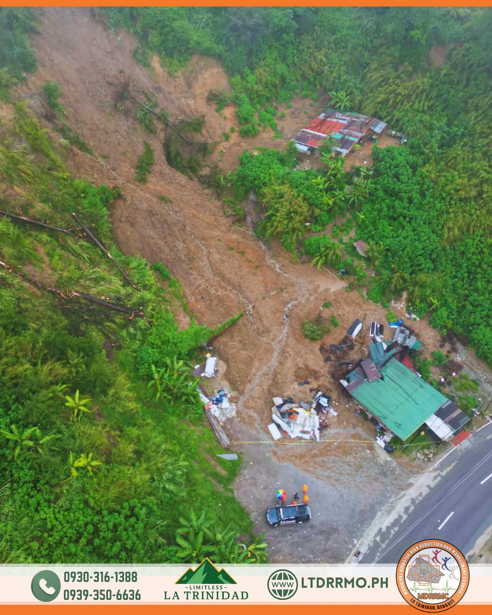
An aerial view released on Saturday shows the devastating extent of a landslide that struck Barangay Shilan in La Trinidad, Benguet, two days prior. The incident has resulted in two confirmed deaths and one injury.
An aerial view taken on Saturday, Aug. 8, shows the extent of the landslide that struck Barangay Shilan in La Trinidad, Benguet, two days earlier, killing two people and leaving another injured. The aerial image, released by the La Trinidad Municipal Disaster Risk Reduction and Management Office (MDRRMO), shows a wide scope of destruction. Benguet province is known for its susceptibility to landslides due to its mountainous terrain. Factors such as heavy rainfall, deforestation, and improper land development are believed to exacerbate the risks of such natural disasters. This incident is likely a result of a combination of these contributing factors. Landslides and flash floods are recurrent events in the Philippines, especially during the rainy season, given the country's predominantly mountainous landscape. While the government has been working on enhancing early warning systems and evacuation plans, many residents remain vulnerable to these disasters. Following this tragedy, calls for increased support for the victims and strengthened measures to prevent future occurrences are growing. Strict enforcement of land-use regulations in mountainous areas and comprehensive disaster preparedness education for local communities are crucial long-term challenges.
Original source
Inquirer NewsInfo