General articles are free for 24 hours after publish.
Thai forces erect container barricades deep inside Cambodian territory in Preah Vihear
Cambodia's State Secretariat for Border Affairs asserts that Thai military container barricades in the An Seh area of Preah Vihear province extend approximately 500 meters into Cambodian territory. The secretariat protests Thailand's occupation and infrastructure destruction, citing French colonial-era maps.
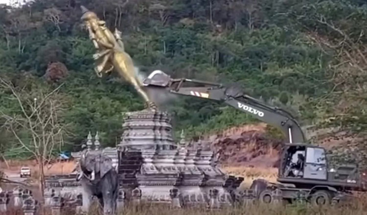
The entire An Seh area in Preah Vihear’s Choam Khsant district — where Thai forces have placed shipping container barricades and destroyed infrastructure — is located within Cambodian territory, according to a senior official from the State Secretariat for Border Affairs (SSBA). Sreu Bora, director-general of the SSBA’s General Department of Border Technical Affairs, told TVK that the Thai barricades are located about 500 metres inside Cambodian territory. He explained that the area is undisputedly in Cambodia, based on the 1:200,000 scale map inherited from the French colonial period through the work of the Indochina-Siam Boundary Commission, based on the 1904 Convention, the 1907 Treaty and several other related documents. The area was occupied by Thailand during the conflict of 2025. “The An Seh Border Checkpoint, or the entire An Seh area, is located in Choam Khsant commune, Choam Khsant district, Preah Vihear province. The border crossing has existed for a very long time. In fact, it appeared on the French-era 1:200,000 scale map,” said Bora. He noted that no border markers have been installed in the area and therefore, it falls under the section of the boundary established under the 1904 Convention. “If we examine the 1:200,000 scale map, it appears on the map sheet as “Khong”, he said. “On this map, it is labelled “Col d’An Seh,” meaning a mountain pass or border crossing between the two countries that has existed since that period — that is, for more than one hundred years. Therefore, this is not a newly established border crossing. Rather, it can be described as a traditional crossing, or even a historic one,” he explained. Before the fighting broke out in 2025, the governments of both nations had agreed to upgrade it to an international border checkpoint. According to Bora, even the L7017 unilateral map produced by the Royal Thai Survey Department, specifically map sheet 5937-1, sows that the area is in Cambodian territory. “If we look at the overall alignment of the two lines, we can see that throughout the entire area I have shown, the two boundary lines are almost identical. There is very little difference between them. “We can see that the border checkpoint is located here, at the far right. I have also highlighted another location that I believe our fellow citizens have not forgotten — the place where the Thai military destroyed a statue of Vishnu and replaced it with one of Buddha,” he said, showing the map. The Vishnu statue, also about 500 metres inside Cambodian was bulldozed by the Thai military on December 24, 2025. Bora explained that both maps showed the location of the statue as inside Cambodian territory. “Therefore, the Thai military carried out the destruction of property located within Cambodian territory,” he said. According to the SSBA, Thai military did not stop with the destruction of the statue. They have installed a Buddha statue and placed razor wire and shipping container barricades. This work was carried out after the Joint Statement was signed on December 27, 2025. “If we examine Thailand’s own unilateral boundary line, all of these activities took place within Cambodian territory. None of them were carried out inside Thai territory,” he said, referring to Thai actions as an attempt to create a “fait accompli”. The Thai military is reportedly attempting to redraft a new map to incorporate this area into Thai territory. “I want to make it clear that Cambodia cannot accept such actions,” Bora said, adding that Cambodia would not acknowledge the unilateral L7017 Thai map or any others they may produce.
Original source
Phnom Penh Post