General articles are free for 24 hours after publish.
Hanoi Plans 11 Park Clusters Along Red River, Developing Scenic Axis
Hanoi has unveiled a draft plan to develop a scenic axis along the Red River, spanning approximately 40km and featuring 11 park clusters. The project, slated for phased implementation from 2026 to 2038, aims to incorporate flood adaptation measures and enhance green and waterfront spaces.
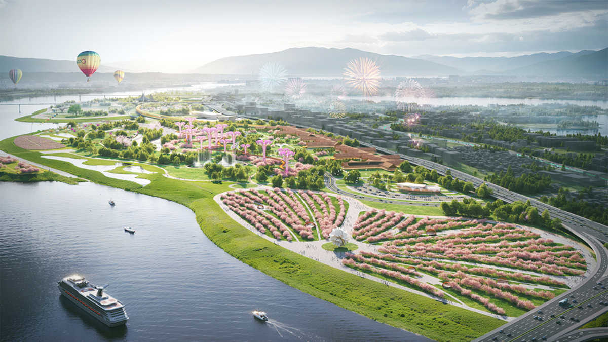
Hanoi City has announced plans to develop 11 park clusters along the Red River as part of a broader initiative to create a scenic axis spanning approximately 40 kilometers. This ambitious project aims to significantly redevelop the urban landscape along the riverbanks and is slated for phased implementation from 2026 to 2038. The plan envisions creating a lush green corridor along both sides of the Red River, emphasizing its natural beauty, historical and cultural significance, and its role as a central urban landscape feature. Simultaneously, it seeks to integrate flood adaptation strategies by designating specific areas for flood discharge, ensuring the safety of natural drainage systems and flood mitigation. Specifically, the project aims to establish a chain of urban parks along the river's alluvial plains, connecting with the city via green axes running east-west. Parks dedicated to nature conservation will be situated in frequently inundated areas. These park clusters represent 11 out of 18 component projects within the overall plan. The first phase, from 2026 to 2030, will see the commencement of public park development in the Phu Phuong and Hong Ha wards. Concurrently, efforts will focus on the scenic axis along both riverbanks, riverbank modifications, the development of an "urban living room" area, resettlement projects in the Linh Nam and Long Bien wards, and independent land acquisition. The plan also incorporates flood-resilient urban planning, with different elevation zones designated for specific uses. Areas above 11.5 meters are allocated for conventional construction, while elevations between 9.5 and 11.5 meters will host flood-adaptive structures like floating houses and stilt houses, along with park and community spaces. Zones from 7.5 to 9.5 meters are prioritized for roads and semi-submerged parks, and areas below 7.5 meters will be used for promenades and fully submerged parks. Beyond the park clusters, the plan includes enhancing connectivity for road, waterway, and urban rail transport, developing 17 bridges across the river along the scenic axis, and transforming cargo ports into tourist facilities, alongside improving navigation channels. The Red River flows over 120 kilometers through Hanoi, and this project covers approximately one-third of that stretch. Source: VnExpress
Original source
VnExpress