General articles are free for 24 hours after publish.
Huai Nam Yen Waterfall Trail: A 10-Kilometer Hike in Chiang Mai
The 10-kilometer Huai Nam Yen Waterfall Trail in Chiang Mai's Omkoi District offers a secluded natural escape managed by the local community. The hike traverses forests and stream crossings, guided by locals to reach the falls. Access requires significant travel time and potentially a 4WD vehicle.
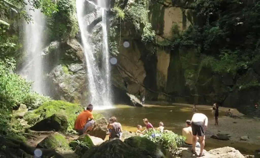
Nestled within the dense forests of Omkoi District, Chiang Mai Province, the Huai Nam Yen Waterfall Trail presents a secluded 10-kilometer trekking experience, offering a peaceful alternative to the more frequented northern Thailand attractions. This route is managed by the local community, with local guides assisting visitors in navigating the rugged terrain. The journey to the waterfall involves traversing forests and crossing streams, with the terrain changing significantly, especially after rain. Travel from Chiang Mai city to Omkoi District can take three to four hours, followed by a rougher final section that may necessitate a 4WD vehicle. The trail itself is approximately 5 kilometers each way, totaling a 10-kilometer round trip. Huai Nam Yen Waterfall is situated in the forest between Ban Na Kian and Ban Mae Khong in Na Kian Subdistrict. The approach combines a rough rural road with a long forest walk, emphasizing a backcountry experience. Travelers typically reach the village area from Omkoi before continuing towards the trailhead by 4WD. The remote rural roads leading to Na Kian and Ban Mae Khong are subject to changing conditions, particularly after rainfall. This trail is best suited for independent-minded hikers who appreciate rural communities and less-developed destinations. Unlike more established parks, there is no clearly verified official page detailing current operating information. It is crucial to contact the local community beforehand to confirm access, fees, guide availability, road conditions, and any temporary closures. The hike is generally rated beginner-friendly, requiring about 4.5 to 6 hours for the full route. While technical climbing is not required, basic fitness and steady footing are essential due to uneven ground, stream crossings, mud, and humid conditions. Sturdy, grippy footwear is highly recommended, along with ample water and sufficient daylight for the return trip. Optimal visiting times are often cited as June through October, when rainfall can enhance the waterfall's flow. However, other sources suggest accessibility from July through February, indicating that the waterfall can be enjoyed beyond the peak wet season. Rainy months bring stronger cascades but also slipperier paths and potential hazards. Drier months can offer easier road and trail conditions. Reported fees are generally modest, but these, along with schedules and visitor limits, are subject to change. Visitors are advised to confirm details locally before making travel arrangements. Access is typically available daily except Wednesdays, with entry between approximately 7:30 a.m. and 11:30 a.m., and departure before 4:00 p.m. Pre-arrangement with the community is necessary. Starting early is recommended to allow ample time for the hike and the return journey. The trek is best treated as a full-day excursion, requiring preparation for heat, humidity, rain, and wet ground. Essential items include water, snacks, insect repellent, a first-aid kit, and a waterproof bag. Visitors are reminded to pack out all trash and avoid relying on shops along the route. Information source: Chiang Rai Times
Original source
Chiang Rai Times