General articles are free for 24 hours after publish.
Super Typhoon Dolphin to Affect Vietnam's Waters Next Week
Super Typhoon Dolphin is forecast to bring strong winds and high waves to Vietnam's waters next week. While direct landfall is unlikely, maritime activities in the South China Sea (East Sea) are expected to be affected, raising concerns for fishing and shipping industries.
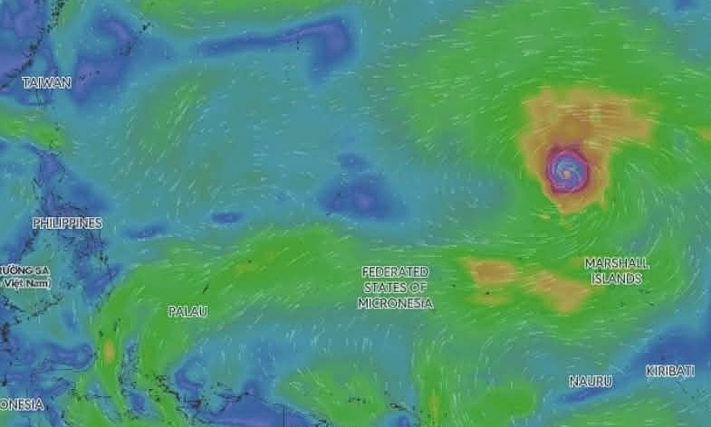
Super Typhoon Dolphin was centered at 16.4 degrees north and 165.8 degrees east on the morning of July 30, according to Vietnam's National Center for Hydro-Meteorological Forecasting. Sustained winds were at the low end of level 17 on Vietnam's scale, roughly 200 kph, with stronger gusts expected. This marks the fourth super typhoon to form over the northwestern Pacific this year, following Sinlaku, Mekkhala, and Bavi. Forecasters anticipate Dolphin will track west-northwest at approximately 20 kph over the next one to three days, then turn west at 20-25 kph toward the Fujian-Zhejiang coast of China. Current model data indicate no sign of the storm moving into the East Sea, internationally known as the South China Sea. However, as Dolphin approaches waters north of Taiwan around August 5, it is expected to draw in the southwest monsoon, strengthening winds across the southern East Sea. No impact is anticipated through August 4. By August 6-7, southwesterly winds over most of the northern, central, and southern East Sea, including waters around the Hoang Sa (Paracel) and Truong Sa (Spratly) islands, could reach 39-61 kph. Waves are forecast at 2-4 meters with very rough seas. The center warned that these conditions could affect vessels operating in the area. The U.S. Joint Typhoon Warning Center forecast Dolphin's peak winds near 305 kph by July 31, measured as a one-minute average. The Japan Meteorological Agency projected about 216 kph on a 10-minute average, a measure that typically yields lower figures for the same storm. AccuWeather described Dolphin as a Category 5-equivalent system passing close to Wake Island and sending heavy surf across scattered islands in the central Pacific. Dolphin intensified rapidly earlier this week over water near 32 degrees Celsius, and forecasters have suggested it may rival Sinlaku as the most powerful storm globally this year. The name Dolphin was contributed by Hong Kong to the World Meteorological Organization's rotating list, referencing the Chinese white dolphin, one of the territory's mascots. Information source: VnExpress International
Original source
VnExpress International