General articles are free for 24 hours after publish.
Heavy rain possible due to low pressure in Bay of Bengal
Ayeyarwaddy Times September 22 Due to the influence of the low-pressure system forming in the central-eastern Bay of Bengal, heavy rains are expected across Myanmar from today, September 22, to September 25, according to
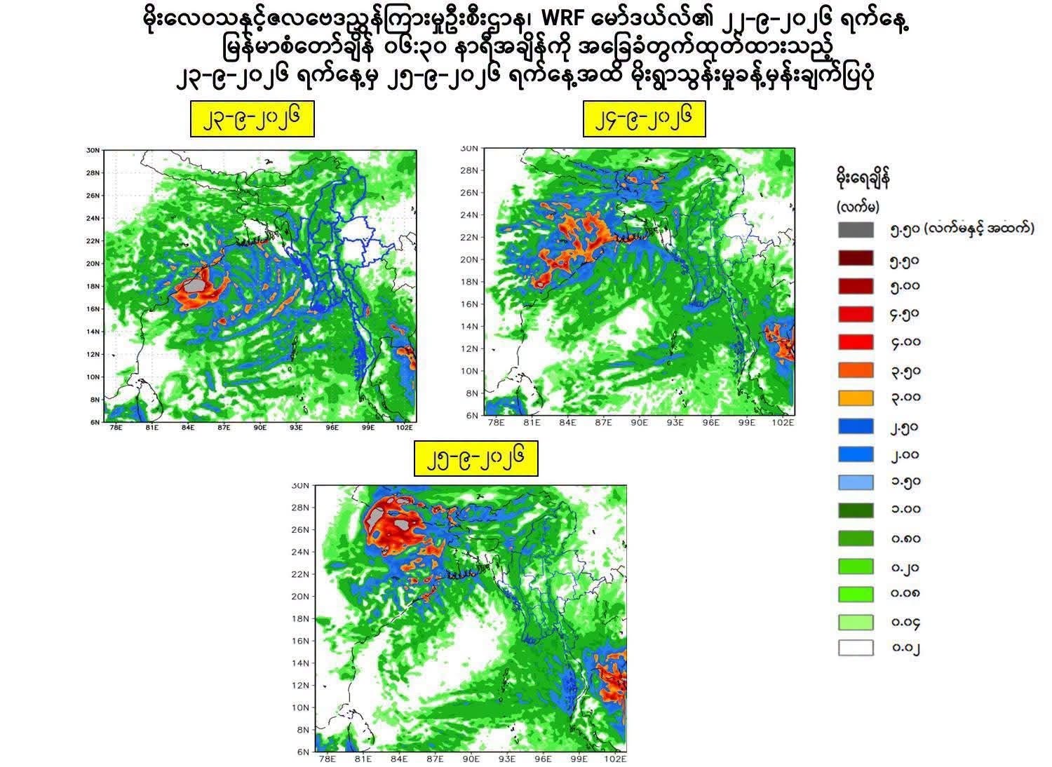
Ayeyarwaddy Times September 22 Due to the influence of the low-pressure system forming in the central-eastern Bay of Bengal, heavy rains are expected across Myanmar from today, September 22, to September 25, according to the Department of Meteorology and Hydrology, which released a statement today. The influence of the low-pressure system will cause scattered to widespread thunderstorms in states and regions, with heavy rains in some areas. The aforementioned low-pressure system is not expected to enter Myanmar and has been issued as a Yellow Level (low pressure formation warning). The Department of Meteorology and Hydrology announced that heavy rains are possible in Yangon Region, Mandalay Region, Bago Region, Magway Region, Lower Sagaing Region, Ayeyarwady Region, Tanintharyi Region, Kayin State, Mon State, and Rakhine State. Furthermore, it was stated that scattered thunderstorms are expected in Upper Sagaing Region, Kachin State, and Shan State (Northern and Eastern). In addition, scattered to widespread thunderstorms are possible in Chin State and Shan State (Southern). Due to the influence of the low-pressure system, along with heavy rainfall, strong winds, sudden floods, and landslides may occur, and residents are warned to exercise caution. Along the Myanmar coast and in the sea off the coast, occasional squalls may occur, with sea and land winds reaching up to 35 miles per hour, and wave heights may range from nine to twelve feet. The low-pressure system is expected to move west-northwest within the next 60 hours and may reach the stage of a Deep Depression in the central and northwestern Bay of Bengal within the next 24 hours, continuing to move west-northwest and potentially crossing the coastlines of northern Andhra Pradesh and southern Odisha in India between the cities of Visakhapatnam and Gopalpur, according to the Department of Meteorology and Hydrology's forecast. International meteorological agencies have stated that the current weather phenomenon is in an El Niño condition, which can lead to extreme weather events such as abnormal rainfall, high daytime temperatures, abnormal storm formations, and droughts. Photo – Department of Meteorology and Hydrology
Original source
Ayeyarwaddy Times