Tropical Storm 'Maymay' Moves North, Signal No. 2 Up in 6 Northern Luzon Areas
Environment
2026年8月5日
3
Philstar Nation

General articles are free for 24 hours after publish.

Tropical Storm 'Maymay' Moves North, Signal No. 2 Up in 6 Northern Luzon Areas

Share
AI Summary

Tropical Storm 'Maymay' is moving north of the Philippines, currently located west of La Union. Gale-force wind warnings (Signal No. 2) are in effect for six areas in Northern Luzon, posing potential threats to property and maritime activities. The storm is forecast to make landfall and subsequently weaken.

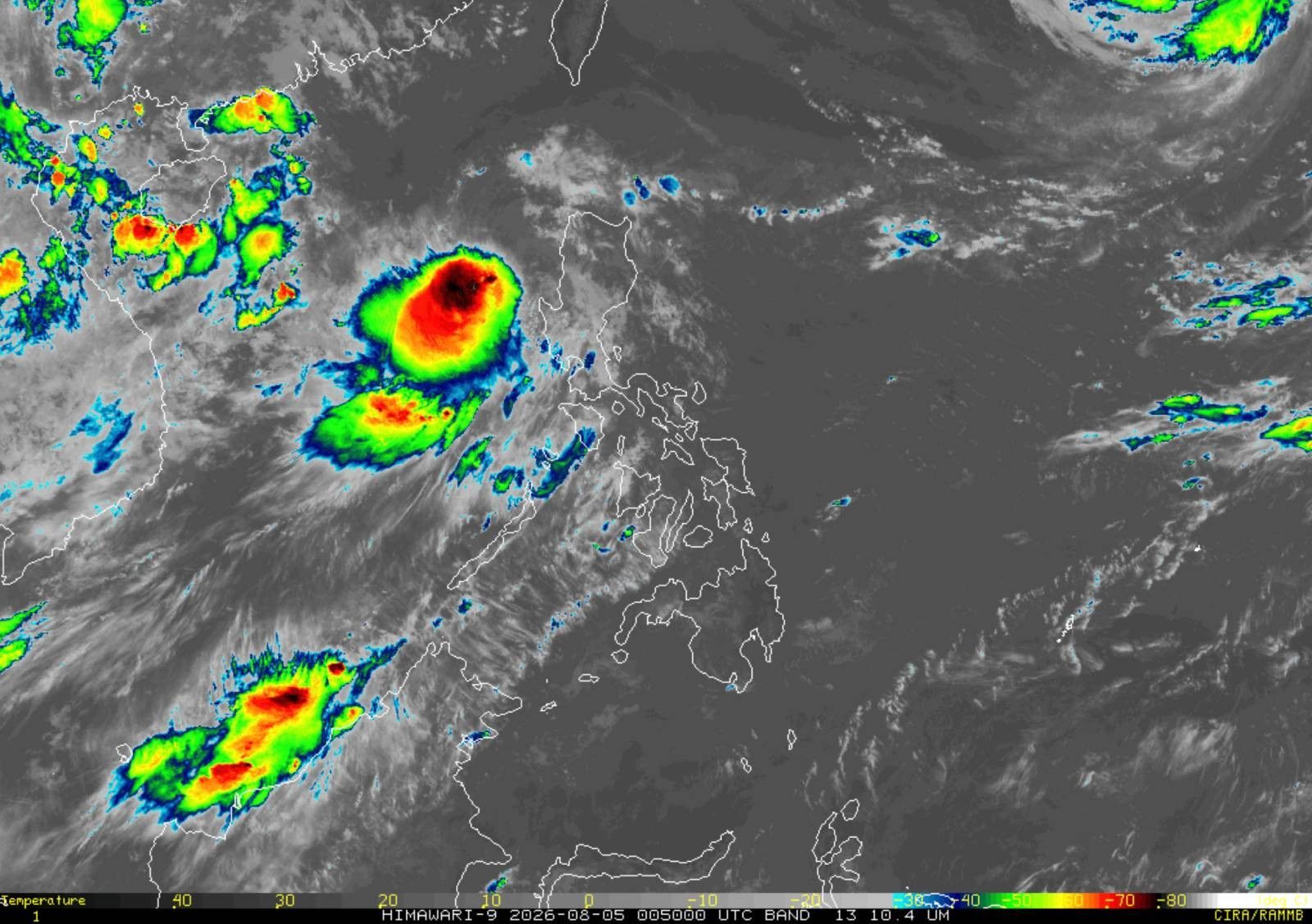
MANILA, Philippines — Tropical Storm Maymay (international name: Kujira) continued to move northward over the sea west of La Union on Wednesday, with some parts of Northern Luzon remaining under Signal No. 2. In its 11 a.m. bulletin on Wednesday, state weather bureau PAGASA said the center of Maymay was estimated at 185 kilometers west northwest of Bacnotan, La Union. It was packing maximum sustained winds of 65 kilometers per hour, gustiness of up to 80 kph, and was moving northward at 10 kph. PAGASA said Maymay may still make landfall over Ilocos Sur or La Union by Wednesday evening or early Thursday before crossing Northern and Central Luzon. Wind signals The following areas are under Signal No. 2: Areas under Signal No. 2 may experience gale-force winds of 62 to 88 kph within 24 hours, posing a minor to moderate threat to life and property. Meanwhile, the following areas are under Signal No. 1: Areas under Signal No. 1 may experience strong winds of 39 to 61 kph within 36 hours, posing minimal to minor threats to life and property. Strong winds, sea conditions PAGASA said the southwest monsoon and the outer circulation of Maymay will continue to bring strong to gale-force gusts over most of Luzon and Visayas on Wednesday. By Thursday and Friday, these gusty conditions may affect most parts of the country. A gale warning also remains in effect over the western seaboard of Northern Luzon. Very rough seas of up to 5 meters are expected over the coasts of Ilocos Sur, La Union and Pangasinan, where all types of vessels are advised to remain in port or seek shelter. Track, intensity PAGASA said Maymay is forecast to move generally eastward and cross Northern and Central Luzon after making landfall. The tropical storm is expected to weaken into a tropical depression by Thursday morning and may further weaken into a low pressure area by Thursday afternoon or evening after moving inland.

0

Original source

Philstar Nation

原文を読む