General articles are free for 24 hours after publish.
Hanoi Unveils Ambitious Red River Scenic Boulevard Plan
Hanoi has announced plans for a scenic boulevard network along both banks of the Red River, totaling approximately 80 km. The project, part of urban development and infrastructure enhancement, is currently seeking public feedback.
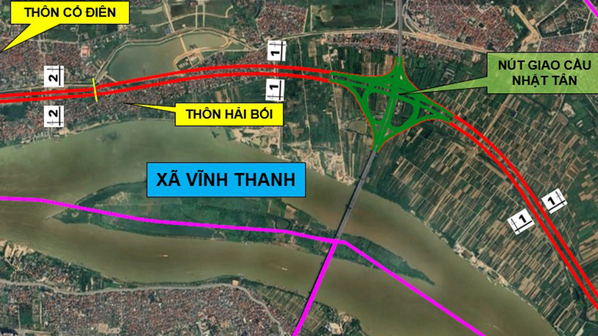
Hanoi, Vietnam's capital, has announced plans to construct an extensive scenic boulevard network along both banks of the Red River, spanning approximately 80 kilometers in total. The project is currently undergoing a public consultation period as part of the city's urban development and infrastructure enhancement initiatives. The proposed network consists of two main routes: the "Left Red River" (Tả Hồng) and the "Right Red River" (Hữu Hồng). The Left Red River route will extend for over 35 kilometers, passing through seven administrative units including communes and wards in Me Linh, Dong Anh, and Long Bien districts. The Right Red River route will be approximately 45 kilometers long, traversing nine administrative units such as communes and wards in Ô Diên, Thượng Cát, and Phú Thượng. These roads are planned to be built in parallel with and largely follow the existing Red River dikes, with an estimated total affected area of over 713 hectares. The project is part of the "Red River Scenic Boulevard Planning (1:500 scale)" and the "Overall Adjustment Plan for the Red River Urban Area Planning (1:5,000 scale)" submitted by the Hanoi People's Committee. A 20-day public feedback period is scheduled from September 7 to September 27. Road widths will vary by section, ranging from 54 meters to 73.5 meters. The plan includes provisions for bypass routes and underground tunnels to minimize the impact on cultural and historical sites, such as temples and churches. For instance, in the Long Bien district, an underpass is planned beneath the Long Bien and Chuong Duong bridges. The development of this scenic boulevard network aims to improve Hanoi's urban landscape, enhance transportation accessibility, and promote development along the Red River. Large-scale infrastructure projects in Vietnam, often driven by national priorities under its one-party system, are expected to contribute to economic growth and urban functional strengthening. The development along the Red River is also seen as a way to accommodate the growing urban population and leverage its potential as a tourist attraction. However, concerns regarding land acquisition and environmental impact are points that will require attention in future resident consensus-building and environmental assessments.
Original source
VnExpress