General articles are free for 24 hours after publish.
Hanoi Seeks Public Opinion on Red River Urban Planning Revision
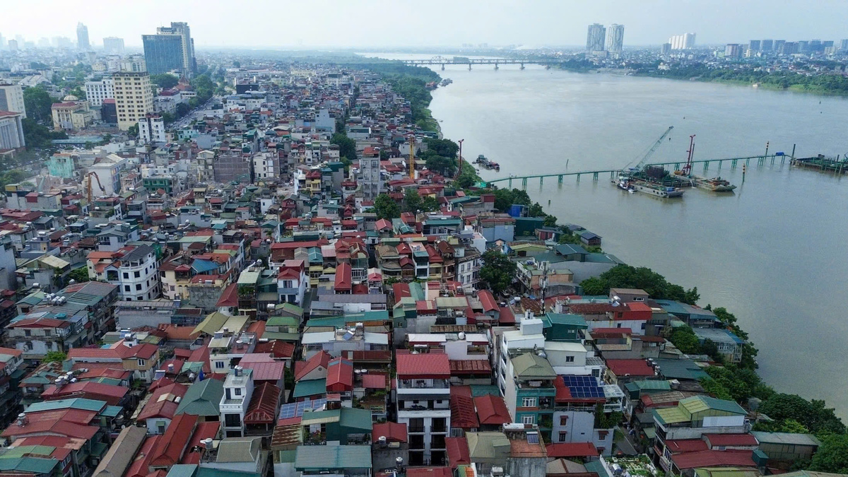
Hanoi will begin soliciting public opinion from September 7 on proposed revisions to the Red River urban development plan (1:5000 scale). The plan aims to develop areas along both banks of the Red River and create a scenic axis.
Hanoi will solicit opinions from agencies, organizations, experts, and residents on revisions to the overall urban development plan along the Red River (scale 1:5000, section from Hong Ha Bridge to Me So Bridge). According to a plan by the Department of Construction on September 5, 16 communes and towns within the planning boundary (Thượng Cát, Đông Ngạc, Phú Thượng, Hồng Hà, Bồ Đề, Long Biên, Lĩnh Nam; Ô Diên, Mê Linh, Thiên Lộc, Vĩnh Thanh, Đông Anh, Bát Tràng, Thanh Trì, Nam Phù, Hồng Vân) and 8 communes and towns in the affected area (Tây Hồ, Hoàn Kiếm, Cửa Nam, Hai Bà Trưng, Vĩnh Tuy, Vĩnh Hưng, Yên Sở and xã Yên Lãng) will organize consultations with agencies, organizations, and experts in the area, and receive written feedback. Residents of the aforementioned communes and towns will submit their opinions directly via opinion forms at their respective commune/town halls. Authorities will organize the posting and display of planning documents at the People's Committees of communes and towns, or at public gathering points within the planned and affected areas. Furthermore, the planning documents (along with electronic opinion forms) will be uploaded to the official websites of the Department of Construction, the Hanoi Urban Planning Institute, and the local information systems to receive and synthesize public opinions through electronic forms. The city plans to organize an online conference to receive feedback and provide responses. The main venue will be at the City People's Committee, connecting online to 126 commune and town venues across the city. The opinion solicitation period begins on September 7 and is expected to last for 20 days. The Red River urban development plan, at a scale of 1:5000, was approved by Hanoi in late March 2022. The scope of the Red River urban development covers 40 km from Hong Ha Bridge to Me So Bridge, with a total area of nearly 11,000 hectares, of which the Red River itself accounts for 3,600 hectares (33%) and the riverbanks over 5,400 hectares (50%). In late 2025, the city tasked relevant agencies with revising the plan in light of the city's implementation of two major planning initiatives: the Hanoi Capital Planning for the period 2021-2030 with a vision to 2050, and the General Planning of Hanoi Capital to 2045 with a vision to 2065. This revision also considers orientations for urban development along both sides of the Red River, including the initiative to invest in the Red River Scenic Axis construction project.
Original source
VnExpress