General articles are free for 24 hours after publish.
Tropical Storm Maymay Makes Landfall in Luzon, Signal No. 2 Up in 6 Areas
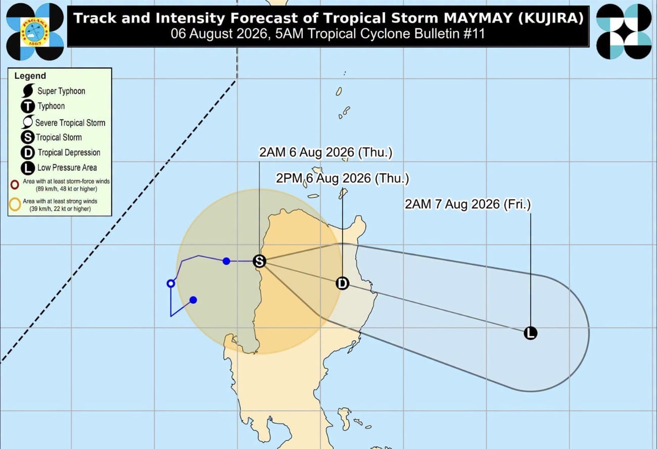
Tropical Storm Maymay made landfall in parts of Northern Luzon, Philippines, prompting the hoisting of Tropical Cyclone Wind Signal No. 2 in several areas, including Magsingal, Ilocos Sur. The weather bureau forecasts continued impact in affected regions.
MANILA, Philippines — Tropical Cyclone Wind Signal No. 2 was maintained over six areas in Northern Luzon after Tropical Storm (TS) Maymay made landfall over Magsingal, Ilocos Sur early Thursday, the state weather bureau said. Pagasa reported on its weather bulletin that Wind Signal No. 2 was hoisted over Ilocos Norte, Ilocos Sur, Abra, Mountain Province, Cagayan, and Batanes. TS Maymay made landfall with maximum sustained winds of 65 kilometers per hour (kph) and gusts of up to 80 kph. It was forecast to move west northwest over Ilocos Norte and exit the Philippine Area of Responsibility (PAR) by Thursday afternoon or evening. However, Pagasa warned that Maymay would still bring moderate to heavy, with at times intense, rains over the northern and central portions of Luzon. Moderate to heavy rains were also expected over the western part of Central Luzon and the rest of Northern Luzon. Pagasa warned of possible flooding and landslides in low-lying and mountainous areas. Meanwhile, Tropical Depression Maymay was the fourth cyclone to enter the PAR this month. Tropical cyclones are common in the Philippines, which lies in the Pacific Ring of Fire, making it prone to natural disasters. In the past, severe weather events have caused significant damage and loss of life, highlighting the importance of disaster preparedness and early warning systems.
Original source
Inquirer NewsInfo