Magnitude 6.2 Earthquake Strikes North Maluku Waters, Felt Across North Sulawesi
A magnitude 6.2 earthquake struck the waters off North Maluku, Indonesia, on Friday morning. While no tsunami threat was reported, tremors were felt as far as North Sulawesi. No significant damage or casualties have been reported.
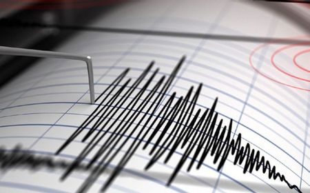
A magnitude 6.2 earthquake struck the waters off the Doi Island area in North Maluku, Indonesia, on Friday morning, July 3. The Meteorology, Climatology and Geophysics Agency (BMKG) confirmed that the earthquake had no potential to cause a tsunami, although tremors were felt in North Sulawesi Province. According to official information from BMKG, the earthquake occurred at 09:31 Western Indonesian Time (WIB). The epicenter was located in the sea at coordinates 1.93 North latitude and 127.39 East longitude, approximately 58 kilometers southwest of Doi Island, North Maluku. BMKG also noted that the epicenter was at a depth of 100 kilometers below sea level, indicating a medium-sized earthquake triggered by tectonic activity. BMKG also noted that the epicenter was located about 272 kilometers from Airmadidi Atas with a depth of 100 kilometers below sea level. This depth indicates that the earthquake is a medium-sized earthquake triggered by tectonic activity. Despite being centered in North Maluku waters, the earthquake's tremors were reported to have been felt by the public in several areas of North Sulawesi, with residents describing feeling the shock for several seconds, causing alertness. Based on BMKG's analysis and community reports, the tremors reached the northern coastal areas of Sulawesi. As of this report, there have been no official reports of significant impacts such as damage to buildings, infrastructure, or casualties. BMKG emphasized that its analysis indicated no tsunami potential for this magnitude 6.2 tectonic earthquake in either North Maluku or North Sulawesi. The public is urged to remain calm and not be provoked by unconfirmed information. Residents are advised to only access information from official sources like BMKG's websites, social media, and applications, and to be cautious of information circulating on social media without verification. BMKG will continue to monitor seismic activity in the region and provide updates if there are significant changes or aftershocks.
多角的分析
今回の地震は、震源が遠く、津波の恐れもないため、直接的な経済的影響は限定的と考えられる。しかし、インフラ被害の有無に関わらず、地域経済の活動、特に観光業や物流に一時的な遅延や不安が生じる可能性はある。北マルク州や北スラウェシ州は、天然資源や漁業が盛んな地域であり、インフラへの軽微な影響でも長期的には生産活動に影響を与えるリスクも否定できない。
M6.2の地震であり、津波の懸念がないことから、広範な市場への影響は低いと予測される。しかし、震源に近い北マルク州や、揺れが伝わった北スラウェシ州のインフラ状況によっては、短期的な物流の停滞や、地域企業の操業に影響が出る可能性は残る。投資家は、公式発表による被害状況の確認と、復旧の迅速さを注視する必要がある。
北マルク州や北スラウェシ州の住民は、地震の揺れを経験し、一時的な不安を感じた。特に、揺れが数秒間続いたことは、住民の警戒心を高めた。現時点で被害報告はないものの、過去の地震経験から、余震への懸念は依然として残る。また、SNS等での不確かな情報拡散は、住民の混乱を招く可能性があるため、公式情報の重要性が改めて浮き彫りになった。
北スラウェシ州の住民は、普段生活している地域で突然の揺れを経験し、驚きと一抹の不安を感じた。数秒間の揺れでも、家の中の物が倒れないか、建物の安全は大丈夫か、といった心配がよぎった。幸い、被害はなかったようだが、いつまた大きな揺れが来るか分からないという、地震国に住む人々の日常的な警戒心が再確認された。SNSで情報が錯綜する中、BMKGからの確かな情報を待つ姿勢が大切だと感じている。
背景・歴史的文脈
インドネシアは「環太平洋造山帯」に位置し、世界でも有数の地震多発国である。特に、北マルク州や北スラウェシ州は、フィリピン海プレートとユーラシアプレートの境界付近にあり、地殻活動が活発な地域として知られている。過去にもこの地域では、津波を伴う大規模な地震が発生しており、住民は常に地震への警戒を強いられている。BMKGは、こうした地域特性を踏まえ、地震発生時の迅速な情報提供と、住民への注意喚起を継続的に行っている。
原文ソース
VOI English