Environment
Super Typhoon 'Inday' Approaches, Expected to Bring Heavy Rains and Strong Winds Without Direct Landfall
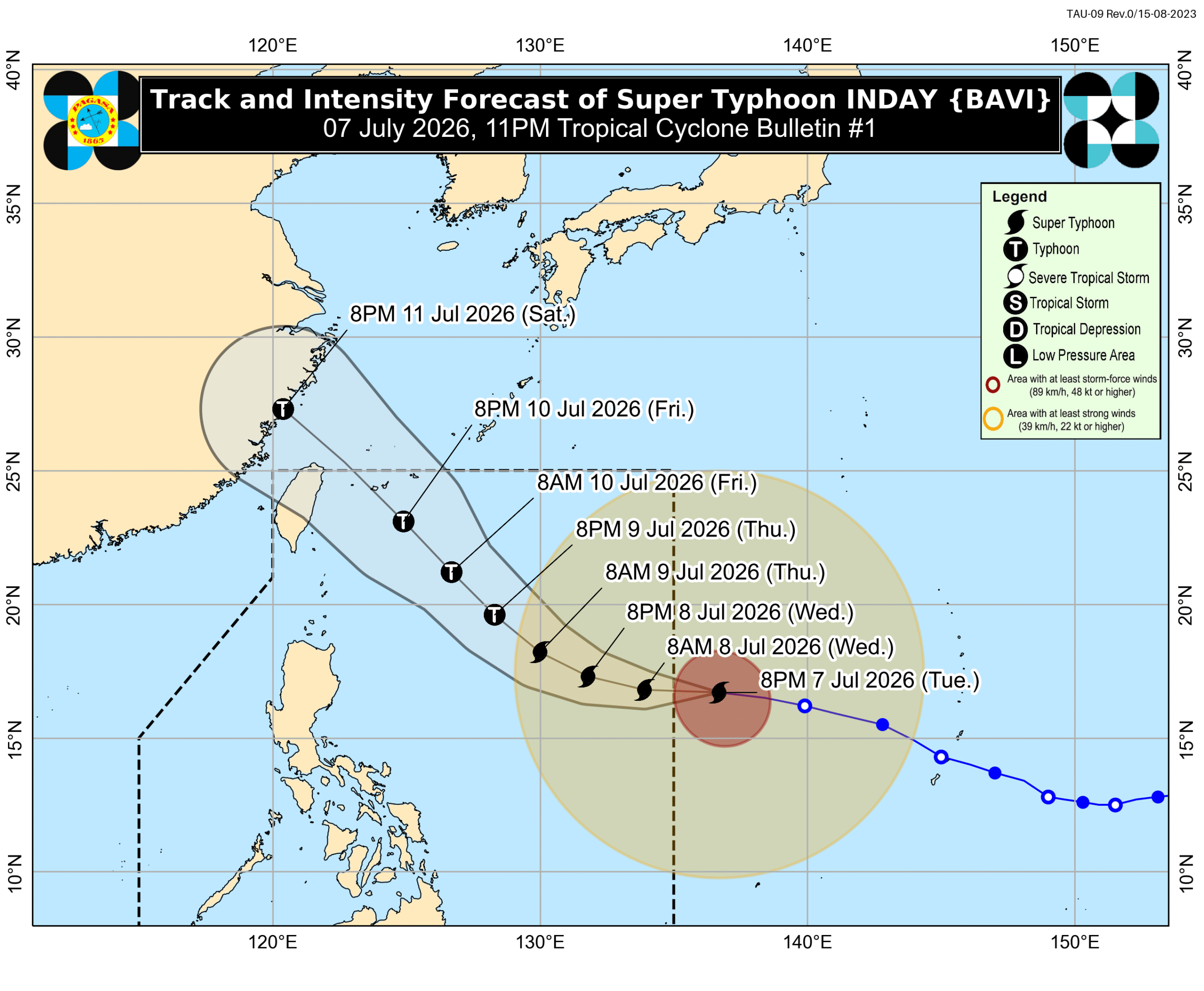
Super Typhoon Bavi, locally named 'Inday' before entering the Philippine Area of Responsibility (PAR), triggered Signal No. 1 in parts of Cagayan on July 7. While direct landfall is not expected, it will enhance the southwest monsoon, bringing potential heavy rains and strong winds across various regions.
This article requires PRO
This article is outside the free access window or is a special report. PRO unlocks it and the full archive.
Related articles
- Super Typhoon Bavi May Enter PAR Tuesday, to be Named 'Inday'
Super Typhoon Bavi is tracking westward over the Philippine Sea and is expected to enter the Philippine Area of Responsibility (PAR) between Tuesday evening and early Wednesday. Once inside, it will be named 'Inday' and is forecast to maintain its super typhoon strength.