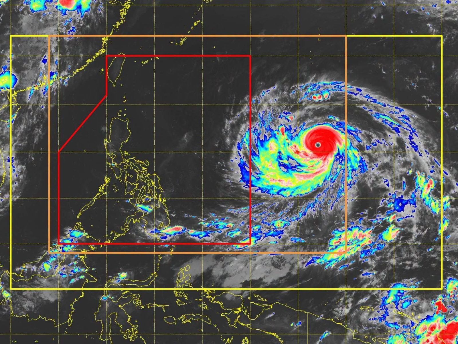
Super Typhoon Bavi May Enter PAR Tuesday, to be Named 'Inday'
Super Typhoon Bavi is tracking westward over the Philippine Sea and is expected to enter the Philippine Area of Responsibility (PAR) between Tuesday evening and early Wednesday. Once inside, it will be named 'Inday' and is forecast to maintain its super typhoon strength.
Super Typhoon Bavi has slightly accelerated as it continues its westward to northwestward track over the Philippine Sea, and is expected to enter the Philippine Area of Responsibility (PAR) between Tuesday evening and early Wednesday. Once inside PAR, the cyclone will be given the local name 'Inday' and is forecast to maintain its super typhoon strength as it moves over the Philippine Sea, according to the state weather bureau PAGASA. In its 11 p.m. tropical cyclone advisory on Monday, July 6, PAGASA reported that Bavi was located 1,950 kilometers east of southeastern Luzon, outside of PAR. The super typhoon was packing maximum sustained winds of 205 kilometers per hour near the center and gustiness of up to 250 kph, with a central pressure of 910 hPa. It was moving west-northwestward at 25 kph. Wind signals, rains. Despite a low chance of making landfall over Luzon, PAGASA indicated that tropical cyclone wind signals may be raised over the northern and eastern portions of northern Luzon as early as Tuesday night or Wednesday morning. The highest wind signal that may be hoisted during Bavi's passage is likely Signal No. 2 or Signal No. 3. The weather bureau also has not ruled out the possibility of raising wind signals over the eastern portions of southern Luzon and the Visayas due to uncertainties in the extent of the cyclone's strong winds. Meanwhile, gusty conditions are expected over most parts of the country between Tuesday and Wednesday due to the enhanced southwest monsoon, locally known as 'habagat'. PAGASA stated that this enhanced southwest monsoon, combined with the effects of Bavi, will also bring heavy rains over the northern and western portions of the country. Track. PAGASA forecasts Bavi to generally move west-northwestward before turning northwestward toward the Ryukyu Islands. The weather bureau predicts the cyclone will gradually weaken as it moves near extreme northern Luzon while approaching eastern Taiwan, although it is expected to remain a super typhoon upon entering PAR.
多角的分析
台風バビの接近は、フィリピン経済に直接的な影響を与える可能性がある。特に、農業部門は甚大な被害を受けるリスクが高い。ルソン島北部の主要な農業地帯が影響を受ける場合、食料供給の不安定化や物価上昇を招く恐れがある。また、インフラへの被害も懸念され、復旧には多額の費用と時間を要することが予想される。これは、政府の財政にも負担をかける要因となりうる。
投資家にとって、台風バビの接近は短期的なリスク要因となる。特に、インフラ関連や農業関連企業は、事業中断や資産損失のリスクに直面する。しかし、長期的な視点では、災害復旧やインフラ再建に関連する投資機会が生まれる可能性もある。ただし、不確実性が高いため、慎重なリスク評価が求められる。
台風バビの接近は、フィリピン国民、特に脆弱なコミュニティに深刻な影響を与える。避難勧告が出されれば、多数の人々が住居を離れる必要に迫られる。また、停電や断水、通信網の寸断は、日常生活に大きな混乱をもたらす。特に、低所得層や沿岸部の住民は、被害からの回復に時間がかかる場合が多い。
台風バビの接近は、マニラ首都圏を含むフィリピン各地の市民生活に直接的な影響を及ぼします。特に、ルソン島北部や東部では、暴風雨による家屋の損壊、停電、交通網の麻痺が懸念されます。避難が必要となる地域では、住民の安全確保が最優先課題となります。また、強まるモンスーンによる雨は、都市部での浸水被害のリスクも高めます。
背景・歴史的文脈
フィリピンは、太平洋「火山の輪」に位置し、台風銀座と呼ばれる地域に属するため、年間を通して多くの台風に見舞われる。特に、7月から10月にかけては台風のシーズンであり、猛烈な勢力の台風が頻繁に発生・接近する。過去には、2013年の台風ヨランダ(ハイエン)のように、甚大な被害をもたらした事例もあり、国民生活や経済に大きな影響を与え続けている。気象庁(PAGASA)による早期警戒システムや、政府・自治体による防災対策が、被害軽減の鍵となっている。
原文ソース
Philstar Nation