General articles are free for 24 hours after publish.
Tropical Storm Queenie enters PAR, may intensify into typhoon over weekend
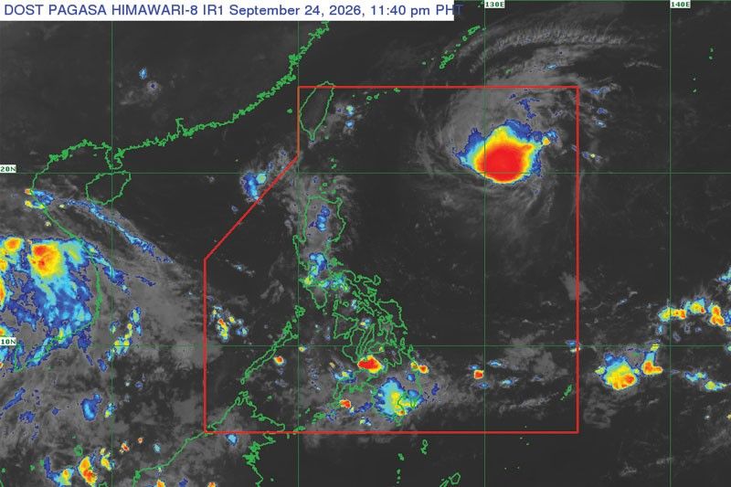
Tropical Storm Queenie has entered the Philippine Area of Responsibility and is forecast to intensify into a typhoon over the weekend, bringing rains to Mindanao and other areas.
Tropical Storm Queenie (international name Surigae) has entered the Philippine Area of Responsibility (PAR), according to the Philippine Atmospheric, Geophysical and Astronomical Services Administration (PAGASA). As of 4 p.m. yesterday, Queenie was located 1,225 kilometers east of northern Luzon, with maximum sustained winds of 75 kilometers per hour and gusts of 90 kph. PAGASA forecasts that Queenie is expected to upgrade into a severe tropical storm by tomorrow afternoon and intensify into a typhoon over the weekend. Cloudy skies with scattered rains and thunderstorms are anticipated in Mindanao, Negros Island Region, Aklan, Iloilo, Guimaras, and Siquijor. The Bicol Region and the rest of the Visayas will experience partly cloudy to cloudy skies with isolated rainshowers or thunderstorms. Metro Manila and the rest of the country will also have partly cloudy to cloudy skies with isolated rainshowers or thunderstorms. Philippines is prone to tropical cyclones, with multiple storms typically affecting the country annually, causing significant damage. Coastal and low-lying areas are particularly vulnerable to infrastructure damage from strong winds and flooding from storm surges. Authorities maintain a state of readiness and issue advisories for potential evacuations.
Original source
Philstar Nation