General articles are free for 24 hours after publish.
ITCZ brings rain over Mindanao; Tropical Storm Surigae may intensify
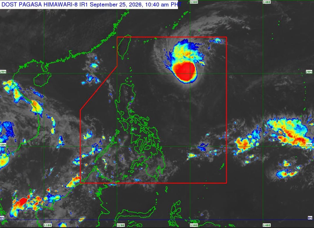
Scattered rains are expected across the Philippines as Tropical Storm Surigae, locally known as Queenie, remains within the Philippine Area of Responsibility and may intensify into a typhoon, the state weather bureau announced.
The entire Mindanao and two areas in the Visayas will experience scattered rains due to the Intertropical Convergence Zone (ITCZ), while Tropical Storm Surigae, locally known as Queenie, remains inside the Philippine Area of Responsibility (PAR) and may intensify into a typhoon, according to the state weather bureau on Friday. “The ITCZ is bringing scattered rains over Mindanao, Negros Oriental, and Siquijor,” Charmagne Varilla, weather specialist at the Philippine Atmospheric, Geophysical and Astronomical Services Administration (PAGASA), said in an 11 a.m. press briefing in Filipino. The rest of the country is likely to experience localized thunderstorms, especially in the afternoon. Meanwhile, Tropical Storm Surigae was located 860 kilometers east of extreme Northern Luzon and slightly intensified, with maximum sustained winds of 75 kilometers per hour (kph) and gusts of up to 90 kph. “It continues to have no direct impact on any part of the country,” Ms. Varilla said. Surigae is likely to intensify into a severe tropical storm on Saturday and recurve away from the country. It is expected to intensify into a typhoon on Sunday before exiting the PAR. Following Surigae’s exit, PAGASA said two tropical cyclone-like vortices may develop in the first week of October, although uncertainty remains high. — Edg Adrian A. Eva
Original source
BusinessWorld Nation