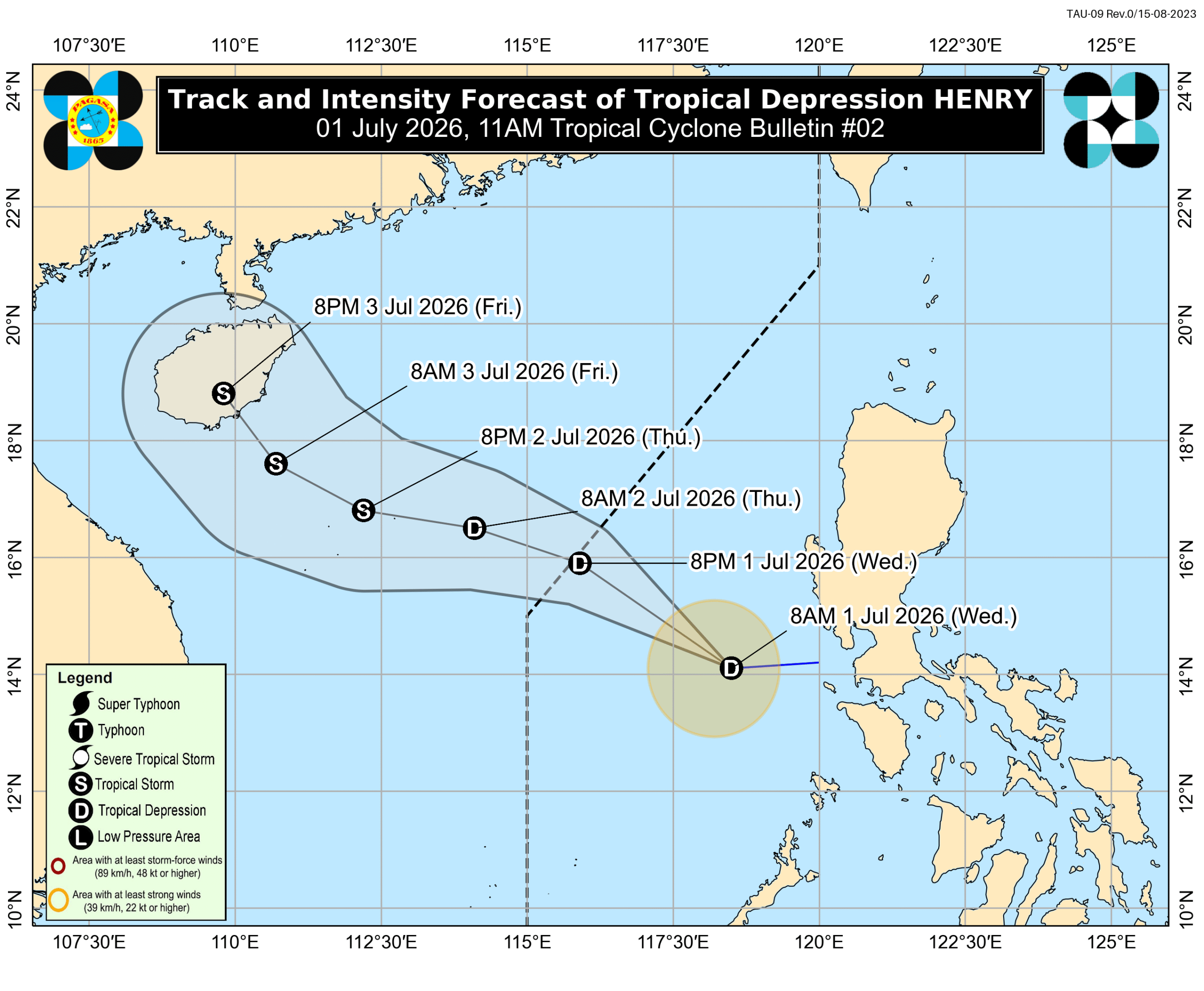
Signal No. 1 lifted as Tropical Depression Henry moves away from land
Tropical Depression Henry moved away from the Philippine landmass, prompting the weather bureau to lift Signal No. 1 for some areas by 10 AM Tuesday. However, strong winds and thunderstorms are still expected in certain regions due to its outer bands and the southwest monsoon.
This article requires PRO
This article is outside the free access window or is a special report. PRO unlocks it and the full archive.
Related articles
- Tropical Depression Henry Forecast to Exit PAR Wednesday Evening or Early Thursday
Tropical Depression Henry is forecast to exit the Philippine Area of Responsibility (PAR) on Wednesday evening or early Thursday, according to the state weather bureau (Pagasa). It is currently moving northwest with maximum sustained winds of 45 kph and may develop into a tropical storm over the West Philippine Sea.
- Tropical Depression Henry leaves PAR on same day it developed
Tropical Depression Henry left the Philippine Area of Responsibility (PAR) at 8 PM on July 1, just 18 hours after its development, according to the Philippine Atmospheric, Geophysical, and Astronomical Services Administration (PAGASA). The cyclone was moving northwest and showed potential for intensification.
- Tropical Depression Henry Forms, Gale-Force Winds Threaten Northern Philippines and Metro Manila
The Philippine Atmospheric, Geophysical and Astronomical Services Administration (PAGASA) announced that a monitored low-pressure area has developed into Tropical Depression Henry. Gale-force winds are expected in nearly 10 areas, including northern Philippines and Metro Manila. Henry is forecast to leave the Philippine Area of Responsibility as early as Thursday morning, but its periphery, along with the southwest monsoon, poses a risk to coastal and upland communities.